MyTopo
Huntsville Utah US Topo Map
Couldn't load pickup availability
Also explore the Huntsville Forest Service Topo of this same quad for updated USFS data
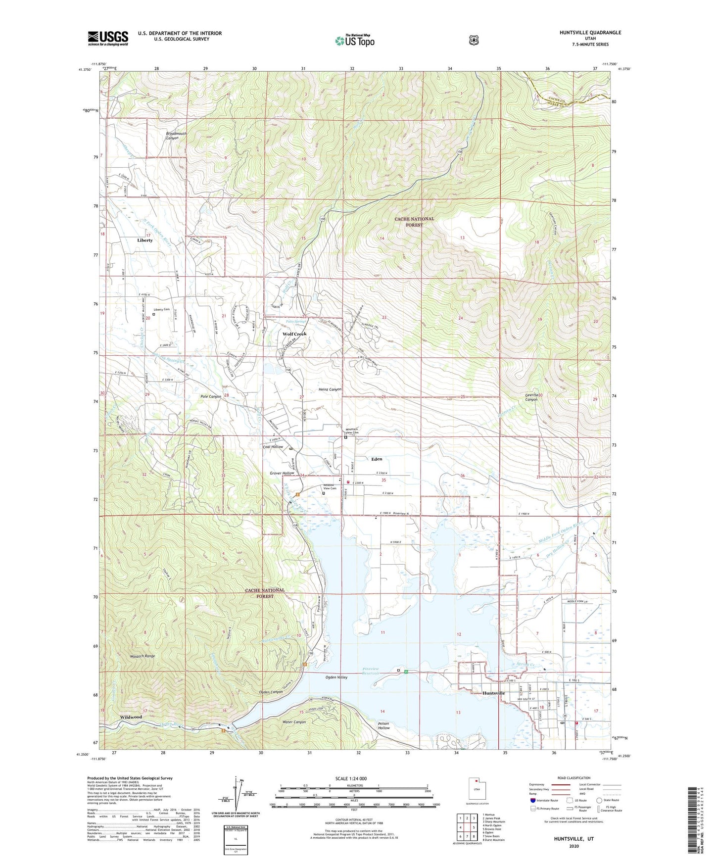
2023 topographic map quadrangle Huntsville in the state of Utah. Scale: 1:24000. Based on the newly updated USGS 7.5' US Topo map series, this map is in the following counties: Weber, Cache. The map contains contour data, water features, and other items you are used to seeing on USGS maps, but also has updated roads and other features. This is the next generation of topographic maps. Printed on high-quality waterproof paper with UV fade-resistant inks.
Quads adjacent to this one:
West: North Ogden
Northwest: Mantua
North: James Peak
Northeast: Sharp Mountain
East: Browns Hole
Southeast: Durst Mountain
South: Snow Basin
Southwest: Ogden
This map covers the same area as the classic USGS quad with code o41111c7.
Contains the following named places: Anderson Cove Campground, Bench Ditch, Big Sky Estates, Blake Holley, Bluffs Recreation Site, Broadmouth Canyon, Cache Valley Creek, Camp Browning, Casey Acres, Chicken Creek, Coal Hollow, Dry Hollow Creek, Eden, Eden Census Designated Place, Eden Hills, Eden Meadows, Eden Post Office, Eden Village, Gardens of Eden, Geertsen Canyon, Gertsen Creek, Goodale Creek, Grover Hollow, Heinz Canyon, Hidden Hole Number 2 Mine, Hidden Hole Number 3 Mine, Holmes-Ferrin Ditch, Huntsville, Huntsville Cemetery, Huntsville Post Office, Jefferson Hunt Campground, Liberty, Liberty Bell Ranchettes, Liberty Cemetery, Liberty Census Designated Place, Liberty Meadows, Liberty Spring Creek, Little Bench Ditch, Meadow View Cemetery, Middle Fork Ogden River, Middle Fork Ranches, Minnie Creek Estates, Mountain View Cemetery, Nordic Valley Estates, Nordic Valley Ski Area, North Arm Campground, North Branch South Fork Ogden River, North Fork Estates, North Fork Ogden River, Ogden Canyon Conduit, Ogden Canyon Wildwood Estates, Ogden Valley, Patio Springs, Pine Creek, Pine View West, Pineview Reservoir, Poison Hollow, Pole Canyon, Powder Mountain Ski Area Heliport, Rattlesnake Creek, Robins Roost, Shanghai Creek, Shanghai Creek Number 1 Mine, Shannon Bee Estates, Sheep Creek, Silver Bell Estates, Smith Creek, Snowcrest High School, South Fork Wolf Creek, Spring Creek, Spurlock, The Church of Jesus Christ of Latter Day Saints, The Point Picnic Area, Town of Huntsville, Union Creek, Water Canyon, Weber Fire District Station 62, Weber Fire District Station 65, Wheeler Creek, Wildwood, Willow Creek, Wolf Creek, Wolf Creek Census Designated Place, Wolf Creek Country Club, Wolf Creek Village, Wolf Star, ZIP Code: 84310