MyTopo
Burnt Mill Spring Utah US Topo Map
Couldn't load pickup availability
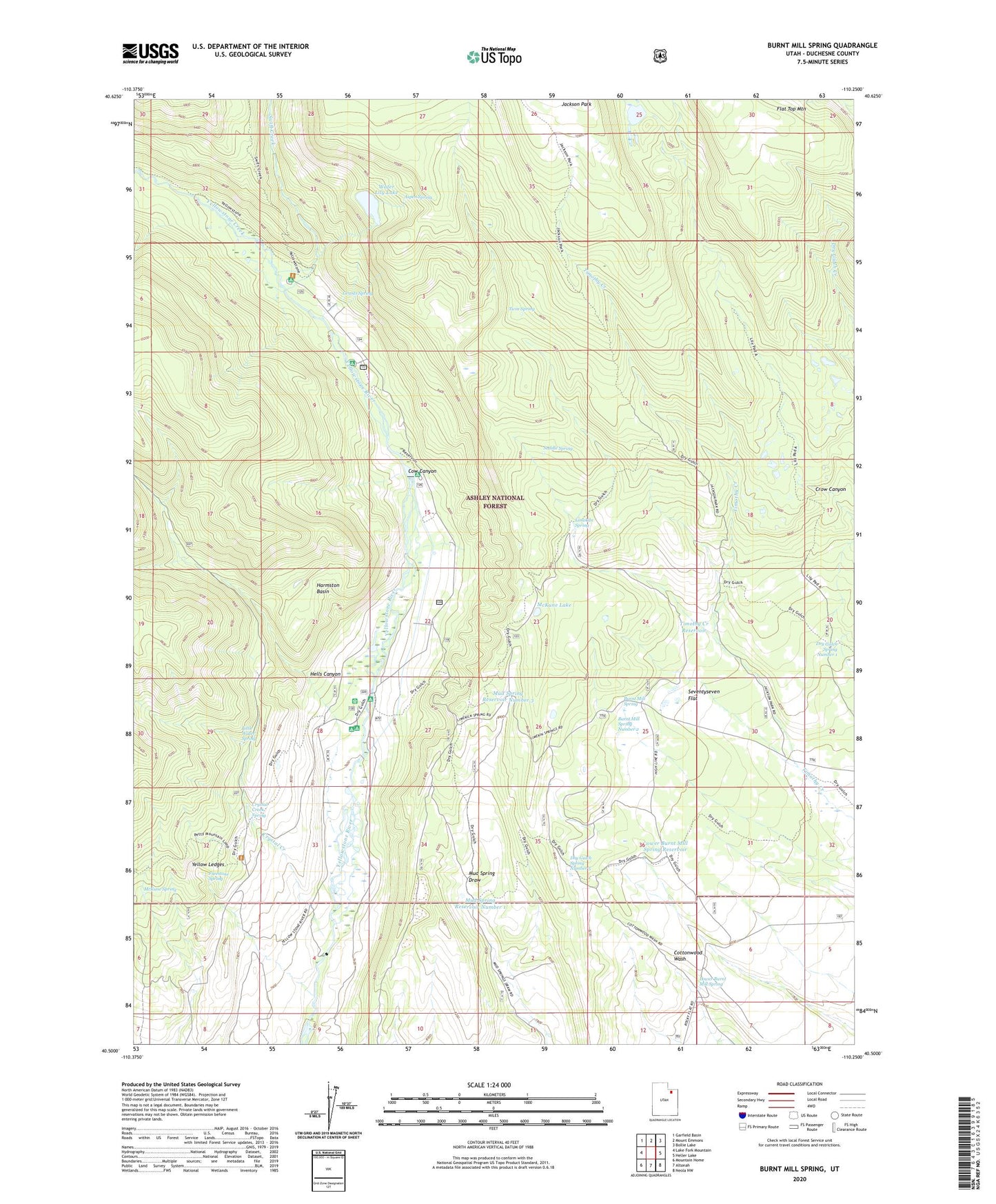
2020 topographic map quadrangle Burnt Mill Spring in the state of Utah. Scale: 1:24000. Based on the newly updated USGS 7.5' US Topo map series, this map is in the following counties: Duchesne. The map contains contour data, water features, and other items you are used to seeing on USGS maps, but also has updated roads and other features. This is the next generation of topographic maps. Printed on high-quality waterproof paper with UV fade-resistant inks.
Quads adjacent to this one:
West: Lake Fork Mountain
Northwest: Garfield Basin
North: Mount Emmons
Northeast: Bollie Lake
East: Heller Lake
Southeast: Neola NW
South: Altonah
Southwest: Mountain Home
Contains the following named places: Aspen Spring, Burnt Mill Spring, Burnt Mill Spring Number 2, Cow Canyon, Crow Canyon, Crystal Creek, Crystal Creek Spring, Crystal Ranch, Dry Gulch Spring Number 1, Dry Gulch Spring Number 5, Flat Top Mountain, Freestone Spring, Grants Spring, Harmston Basin, Hells Canyon, Limekiln Spring, Little Water Spring, Lower Burnt Mill Spring, Lower Burnt Mill Spring Reservoir, McKune Lake, McKune Spring, Mud Spring Reservoir Number 1, Mud Spring Reservoir Number 3, Reservoir Campground, Riverview Campground, Saddle Spring, Seventyseven Flat, Swift Creek, Swift Creek Campground, Timothy Creek Reservoir, Twin Spring, Water Lily Lake, Water Lily Lake Dam, Yellow Ledges, Yellowstone Bridge Campground, Yellowstone Campground, Yellowstone Corral, Yellowstone Creek, Yellowstone Guard Station, Yellowstone Power Diversion Dam, Yellowstone Power Diversion Reservoir, Yellowstone Ranch