MyTopo
Central East Utah US Topo Map
Couldn't load pickup availability
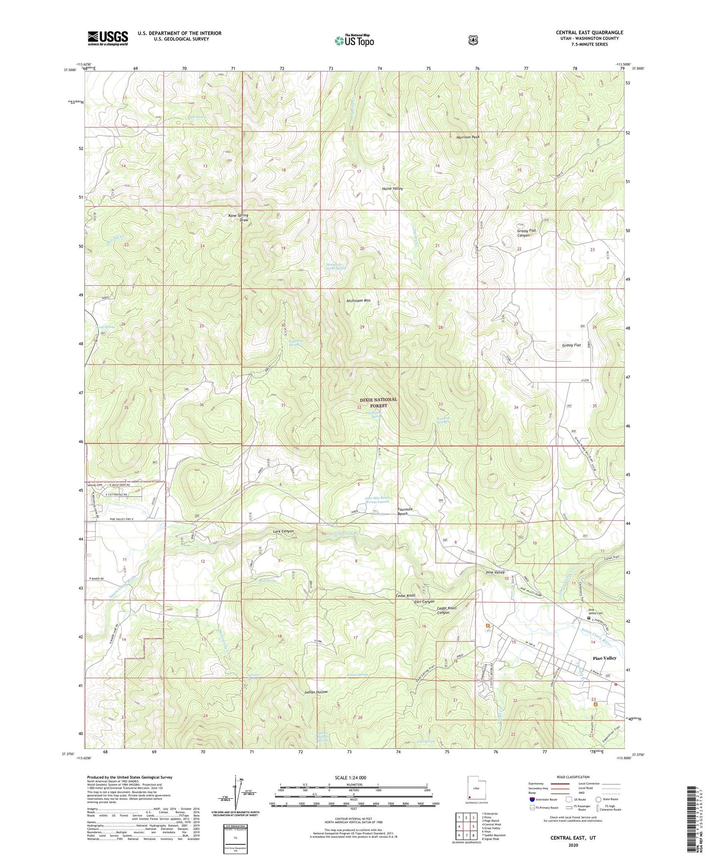
2020 topographic map quadrangle Central East in the state of Utah. Scale: 1:24000. Based on the newly updated USGS 7.5' US Topo map series, this map is in the following counties: Washington. The map contains contour data, water features, and other items you are used to seeing on USGS maps, but also has updated roads and other features. This is the next generation of topographic maps. Printed on high-quality waterproof paper with UV fade-resistant inks.
Quads adjacent to this one:
West: Central West
Northwest: Enterprise
North: Pinto
Northeast: Page Ranch
East: Grass Valley
Southeast: Signal Peak
South: Saddle Mountain
Southwest: Veyo
Contains the following named places: Atchinson Mountain, Atchinson Spring, Cedar Knoll, Cedar Knoll Canyon, Central, Earl Canyon, Earl Spring, Eightmile Spring, Enterprise Division, Forsyth Creek, Four Mile Bench Sewage Lagoon, Fourmile Bench, Fourmile Spring, Grass Valley Creek, Grassy Flat, Harrison Peak, Horse Valley, Indian Hollow, Indian Hollow Spring, Indian Spring, Kane Spring, Lark Canyon, Lloyd Creek, Mahogany Creek, Mountain Home Spring, Mud Spring, Nervine Spring, Oak Spring, Pine Valley, Pine Valley Cemetery, Pine Valley Census Designated Place, Pine Valley Church Historical Site, Pine Valley Fire Department, Pine Valley Post Office, Pine Valley Work Center, ZIP Code: 84722