MyTopo
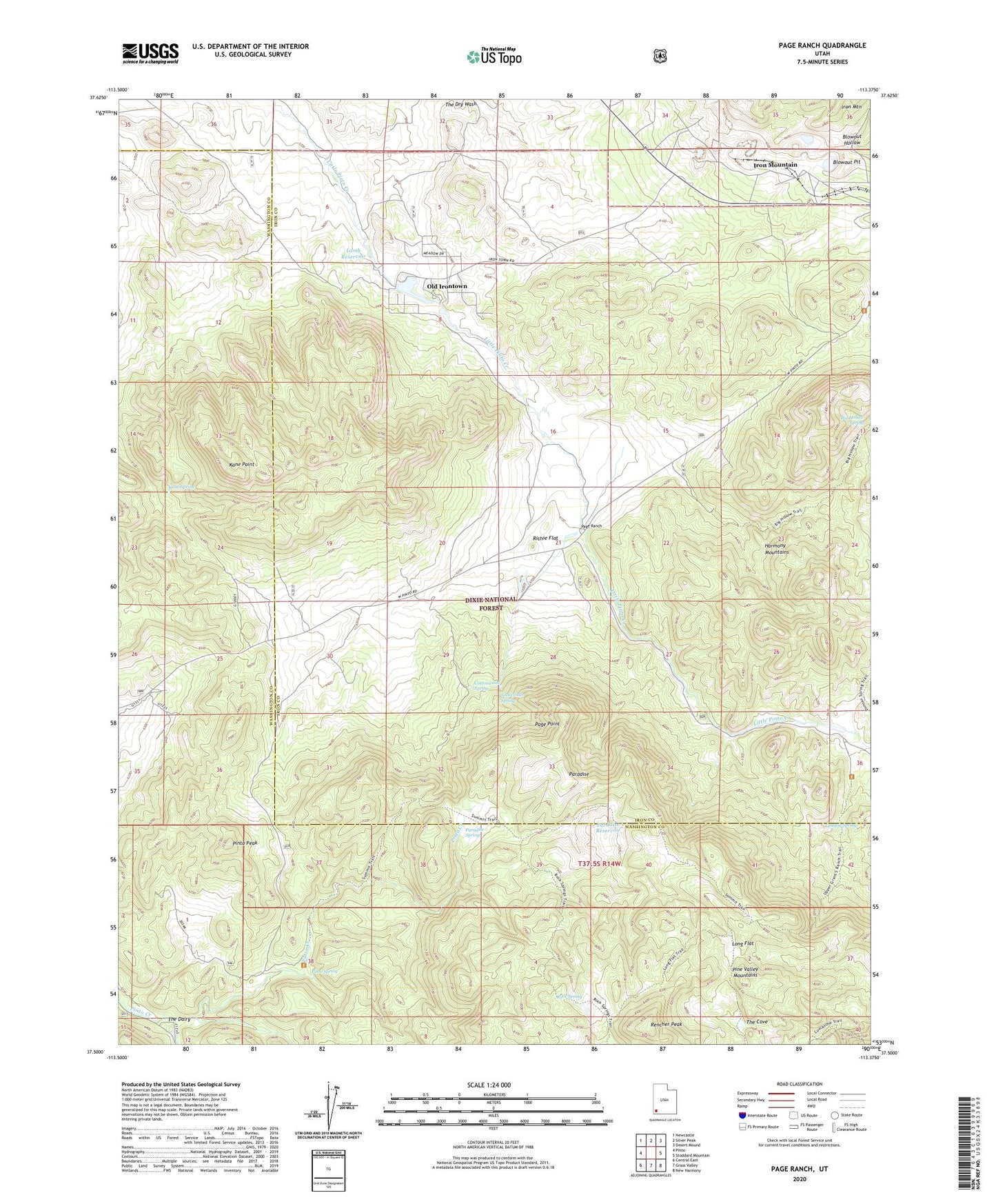
Page Ranch Utah US Topo Map
Couldn't load pickup availability
Also explore the Page Ranch Forest Service Topo of this same quad for updated USFS data
2023 topographic map quadrangle Page Ranch in the state of Utah. Scale: 1:24000. Based on the newly updated USGS 7.5' US Topo map series, this map is in the following counties: Iron, Washington. The map contains contour data, water features, and other items you are used to seeing on USGS maps, but also has updated roads and other features. This is the next generation of topographic maps. Printed on high-quality waterproof paper with UV fade-resistant inks.
Quads adjacent to this one:
West: Pinto
Northwest: Newcastle
North: Silver Peak
Northeast: Desert Mound
East: Stoddard Mountain
Southeast: New Harmony
South: Grass Valley
Southwest: Central East
This map covers the same area as the classic USGS quad with code o37113e4.
Contains the following named places: Big Hollow Spring, Big Hollow Trail, Blowout Hollow, Blowout Pit, Colorado Mine, Columbia Steel Mine, Cottonwood Spring, Gordon Spring, Grants Ranch, Iron Mountain, Kane Point, Kane Spring, Lamb Reservoir, Lockeridge Spring, Long Flat, Old Irontown, Page Point, Page Ranch, Paradise, Paradise Reservoir, Paradise Spring, Pinto Peak, Pinto Spring, Rencher Peak, Richie Flat, Rock Spring, South Fork Pinto Creek, Stewart Lamb Dam, The Cove, The Dairy, Upper Grants Ranch, Upper Grants Ranch Trail, Whiterocks Trail