MyTopo
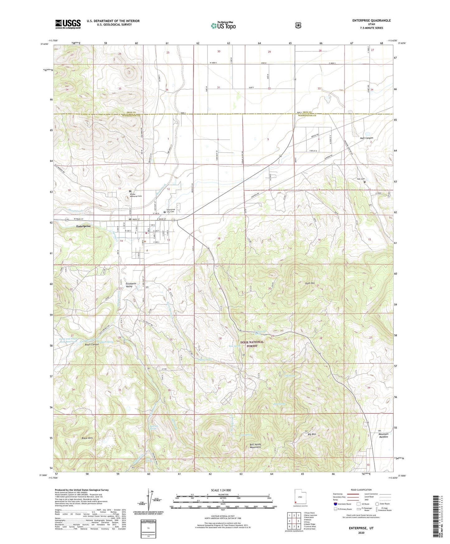
Enterprise Utah US Topo Map
Couldn't load pickup availability
Also explore the Enterprise Forest Service Topo of this same quad for updated USFS data
2023 topographic map quadrangle Enterprise in the state of Utah. Scale: 1:24000. Based on the newly updated USGS 7.5' US Topo map series, this map is in the following counties: Washington, Iron. The map contains contour data, water features, and other items you are used to seeing on USGS maps, but also has updated roads and other features. This is the next generation of topographic maps. Printed on high-quality waterproof paper with UV fade-resistant inks.
Quads adjacent to this one:
West: Hebron
Northwest: Pinon Point
North: Beryl Junction
Northeast: Newcastle
East: Pinto
Southeast: Central East
South: Central West
Southwest: Maple Ridge
This map covers the same area as the classic USGS quad with code o37113e6.
Contains the following named places: Big Mountain, Big Mountain Electronic Site, Black Canyon, Bullrush Creek, Bullrush Spring, Calf Springs Creek, City of Enterprise, Cliff Spring, Cottonwood Spring, Cottonwood Wash, Enterprise, Enterprise Administrative Site, Enterprise City Cemetery, Enterprise Elementary School, Enterprise High School, Enterprise Marshal's Office, Enterprise Post Office, Enterprise Volunteer Fire Department, Enterprise Work Center, Gary and Joyce Holt Reservoir, Gary and Joyce Holt Reservoir Dam, Gum Hill, Holt Canyon, Holt Cemetery, Holt Historical Site, Mud Spring, Pendleton Spring, Rose Spring, Shinbone Creek, Spring Creek, The Church of Jesus Christ of Latter Day Saints, Tom Spring, Twin Spring, Twin Spring Creek, Willow Spring, Winsor Memorial Cemetery