MyTopo
Chester Utah US Topo Map
Couldn't load pickup availability
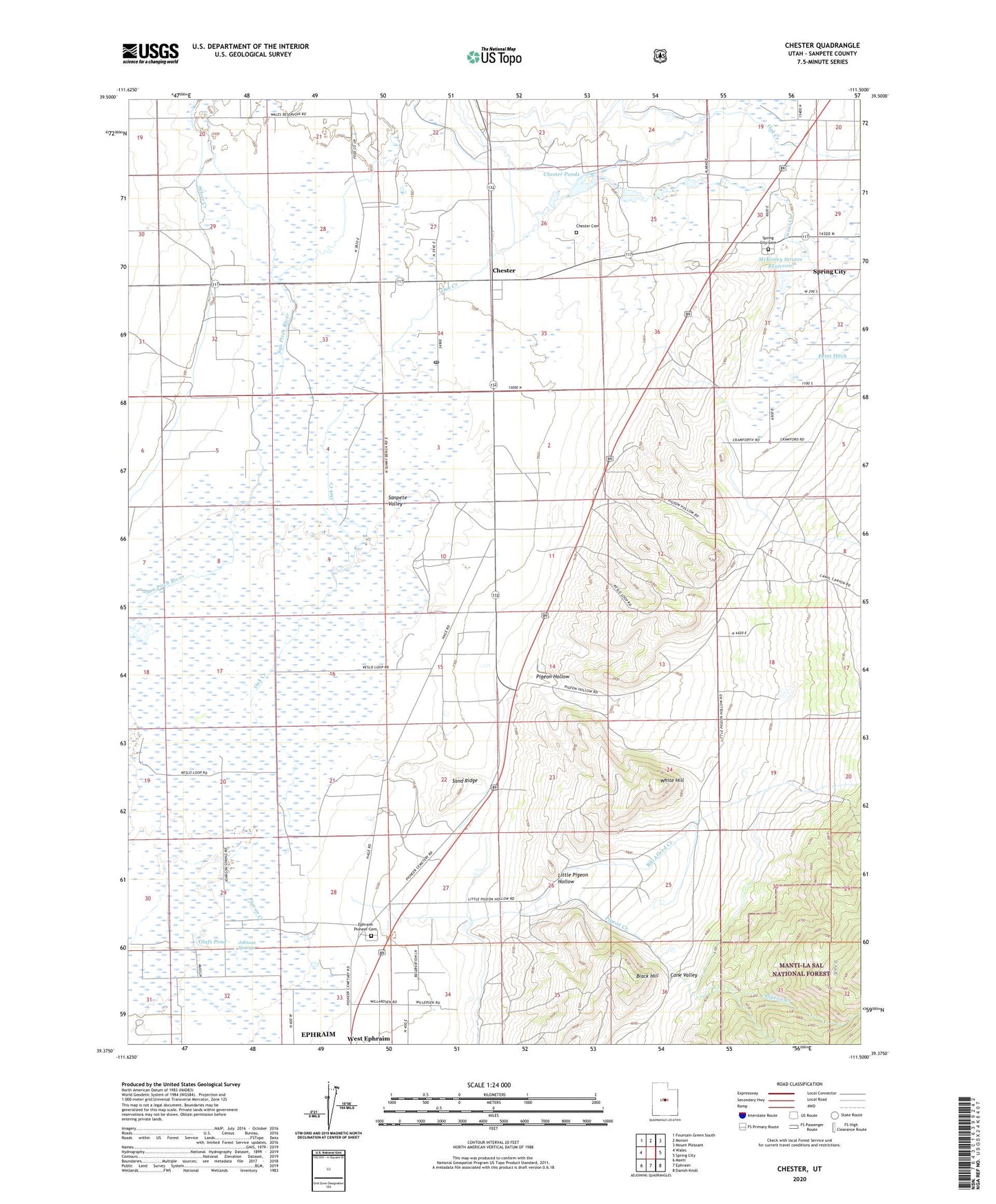
2020 topographic map quadrangle Chester in the state of Utah. Scale: 1:24000. Based on the newly updated USGS 7.5' US Topo map series, this map is in the following counties: Sanpete. The map contains contour data, water features, and other items you are used to seeing on USGS maps, but also has updated roads and other features. This is the next generation of topographic maps. Printed on high-quality waterproof paper with UV fade-resistant inks.
Quads adjacent to this one:
West: Wales
Northwest: Fountain Green South
North: Moroni
Northeast: Mount Pleasant
East: Spring City
Southeast: Danish Knoll
South: Ephraim
Southwest: Manti
Contains the following named places: Bill Allred Creek, Bill Allred Ditch, Black Hill, Black Hills Wildlife Management Area, Canal Creek, Chester, Chester Cemetery, Chester Ponds, Chester Post Office, Crawford Ditch, Ephraim Pioneer Cemetery, Gobblefield Ditch, Johnson Springs, Little Pigeon Hollow, Lower Chimney Ditch, McKinley Strates Dam, McKinley Strates Reservoir, Olafs Pond, Pigeon Creek, Pigeon Hollow, Pigeon Hollow Junction, Rock Dam Canal, Sand Ridge, Silver Creek, Silver Creek Ditch, Spring City Cemetery, Spring City Wildlife Management Area, Spring Ditch, The Canal Ditch, Upper Chimney Ditch, West Ephraim, White Hill, ZIP Code: 84623