MyTopo
Manti Utah US Topo Map
Couldn't load pickup availability
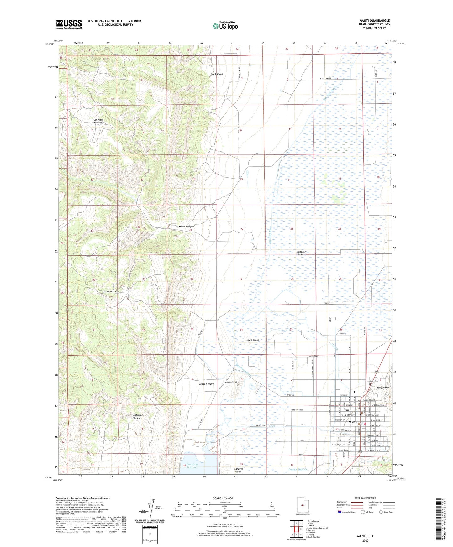
2023 topographic map quadrangle Manti in the state of Utah. Scale: 1:24000. Based on the newly updated USGS 7.5' US Topo map series, this map is in the following counties: Sanpete. The map contains contour data, water features, and other items you are used to seeing on USGS maps, but also has updated roads and other features. This is the next generation of topographic maps. Printed on high-quality waterproof paper with UV fade-resistant inks.
Quads adjacent to this one:
West: Hells Kitchen Canyon SE
Northwest: Chriss Canyon
North: Wales
Northeast: Chester
East: Ephraim
Southeast: Black Mountain
South: Sterling
Southwest: Gunnison
This map covers the same area as the classic USGS quad with code o39111c6.
Contains the following named places: City Creek, City of Manti, Davis Trailer Court and RV Campground, Dodge Canyon, Dry Canyon, High Water Canal, KMTI-AM (Manti), KSME-FM (Manti), Manti, Manti Ambulance Service, Manti Campground, Manti Cemetery, Manti Elementary School, Manti High School, Manti Post Office, Manti Temple, Manti Volunteer Fire Department, Maple Canyon, River Knoll, South Creek, South Neba Wildlife Management Area, State of Utah, Temple Hill, The Church of Jesus Christ of Latter Day Saints, Twin Knolls