MyTopo
Wales Utah US Topo Map
Couldn't load pickup availability
Also explore the Wales Forest Service Topo of this same quad for updated USFS data
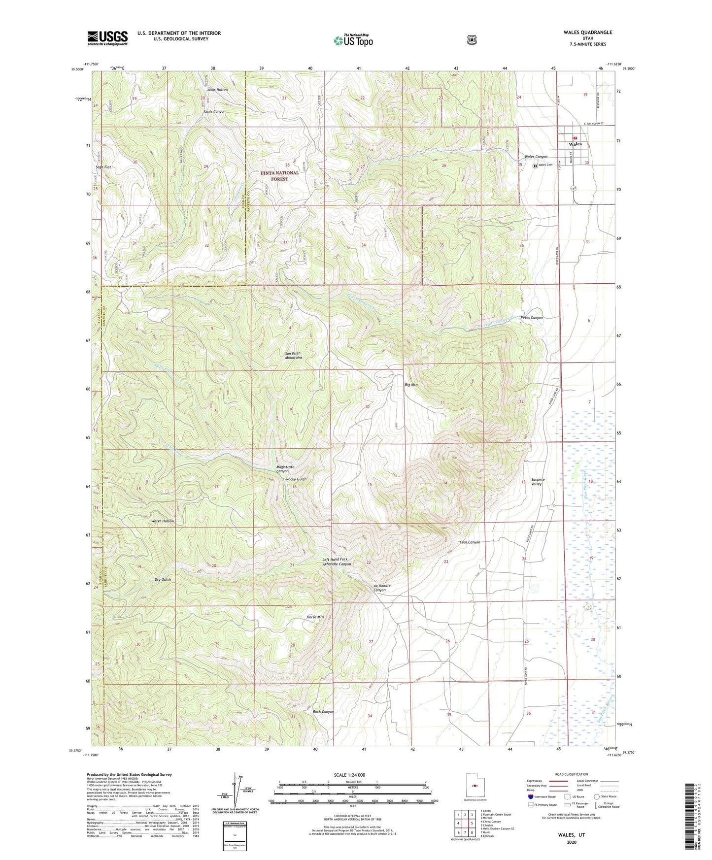
2023 topographic map quadrangle Wales in the state of Utah. Scale: 1:24000. Based on the newly updated USGS 7.5' US Topo map series, this map is in the following counties: Sanpete, Juab. The map contains contour data, water features, and other items you are used to seeing on USGS maps, but also has updated roads and other features. This is the next generation of topographic maps. Printed on high-quality waterproof paper with UV fade-resistant inks.
Quads adjacent to this one:
West: Chriss Canyon
Northwest: Levan
North: Fountain Green South
Northeast: Moroni
East: Chester
Southeast: Ephraim
South: Manti
Southwest: Hells Kitchen Canyon SE
This map covers the same area as the classic USGS quad with code o39111d6.
Contains the following named places: Ax Handle Canyon, Big Mountain, Coal Canyon, Dells Fork, Dry Gulch, Horse Mountain, Jacks Hollow, Left Hand Fork Axhandle Canyon, Magistrate Canyon, Oak Creek, Peach Canyon Creek, Petes Canyon, Petes Fork, Rock Canyon, Rocky Gulch, Sauls Canyon, The Church of Jesus Christ of Latter Day Saints, Town of Wales, Wales, Wales Canyon, Wales Cemetery, Wales Volunteer Fire Department, Water Hollow