MyTopo
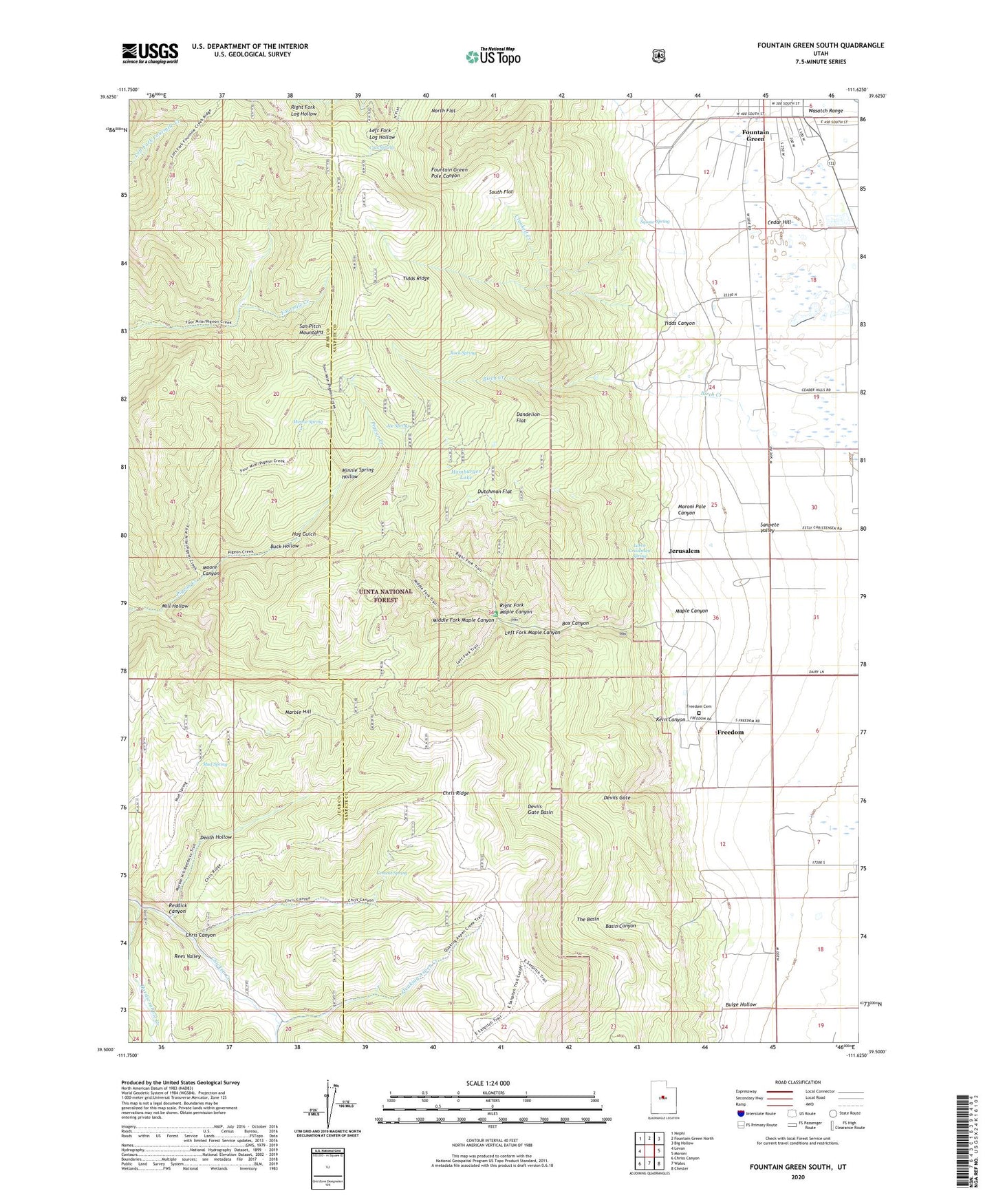
Fountain Green South Utah US Topo Map
Couldn't load pickup availability
Also explore the Fountain Green South Forest Service Topo of this same quad for updated USFS data
2023 topographic map quadrangle Fountain Green South in the state of Utah. Scale: 1:24000. Based on the newly updated USGS 7.5' US Topo map series, this map is in the following counties: Sanpete, Juab. The map contains contour data, water features, and other items you are used to seeing on USGS maps, but also has updated roads and other features. This is the next generation of topographic maps. Printed on high-quality waterproof paper with UV fade-resistant inks.
Quads adjacent to this one:
West: Levan
Northwest: Nephi
North: Fountain Green North
Northeast: Big Hollow
East: Moroni
Southeast: Chester
South: Wales
Southwest: Chriss Canyon
This map covers the same area as the classic USGS quad with code o39111e6.
Contains the following named places: Basin Canyon, Birch Creek, Box Canyon, Buck Hollow, Bulge Hollow, Cedar Hill, Cement Spring, Chris Canyon, Chris Ridge, Cool Spring, Crooked Creek, Dandelion Flat, Death Hollow, Devils Gate, Devils Gate Basin, Dutchman Flat, Freedom, Freedom Cemetery, Hamburger Lake, Hardscrabble Creek, Hog Gulch, Jerusalem, Joe Spring, Kern Canyon, Larch Cristensen Spring, Left Fork Maple Canyon, Maple Canyon, Maple Canyon Campground, Marble Hill, Middle Fork Maple Canyon, Mill Hollow, Minnie Spring, Minnie Spring Hollow, Moore Canyon, Moroni District Ranger Station, Moroni Pole Canyon, Moroni Ranger Station, Mud Spring, Quaking Aspen Creek, Reddick Canyon, Rees Valley, Right Fork Maple Canyon, Rock Spring, South Flat, Squaw Spring, The Basin, Tidds Canyon, Tidds Ridge, ZIP Codes: 84632, 84667