MyTopo
Christmas Meadows Utah US Topo Map
Couldn't load pickup availability
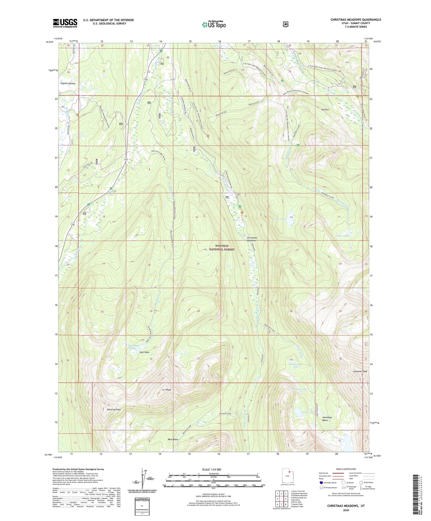
2020 topographic map quadrangle Christmas Meadows in the state of Utah. Scale: 1:24000. Based on the newly updated USGS 7.5' US Topo map series, this map is in the following counties: Summit. The map contains contour data, water features, and other items you are used to seeing on USGS maps, but also has updated roads and other features. This is the next generation of topographic maps. Printed on high-quality waterproof paper with UV fade-resistant inks.
Quads adjacent to this one:
West: Whitney Reservoir
Northwest: Seven Tree Flat
North: Deadman Mountain
Northeast: Elizabeth Mountain
East: Red Knob
Southeast: Explorer Peak
South: Hayden Peak
Southwest: Mirror Lake
Contains the following named places: A-1 Peak, Amethyst Basin, Amethyst Lake, Baker Lake, Bear River Smiths Fork Trail, Beaver View Campground, Boundary Creek, Christmas Meadow Summer Home Area, Christmas Meadows, Christmas Meadows Campground, Coyote Hollow, East Fork Bear River Camp, Hayden Fork, Hayden Fork Campground, Hell Hole, Hell Hole Lake, Kletting Peak, Lamotte Peak, Main Fork, Old Burn, Ostler Fork, Ostler Lake, Price Dam, Salamander Lake, Scow Lake, Stillwater Campground, Stillwater Fork, Toomset Lake, West Basin, Windsor Dam, Wolverine Recreation Trailhead