MyTopo
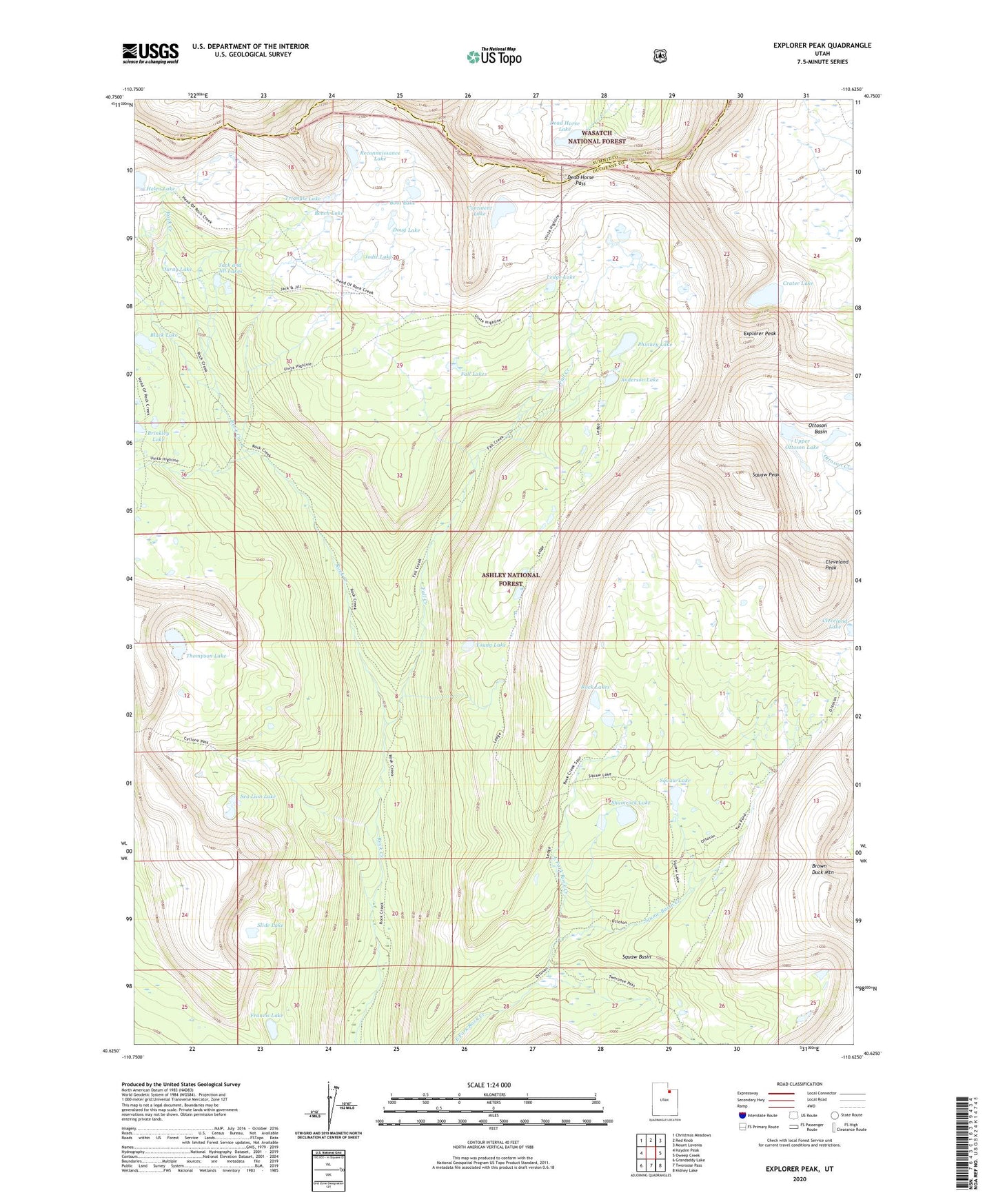
Explorer Peak Utah US Topo Map
Couldn't load pickup availability
Also explore the Explorer Peak Forest Service Topo of this same quad for updated USFS data
2023 topographic map quadrangle Explorer Peak in the state of Utah. Scale: 1:24000. Based on the newly updated USGS 7.5' US Topo map series, this map is in the following counties: Duchesne, Summit. The map contains contour data, water features, and other items you are used to seeing on USGS maps, but also has updated roads and other features. This is the next generation of topographic maps. Printed on high-quality waterproof paper with UV fade-resistant inks.
Quads adjacent to this one:
West: Hayden Peak
Northwest: Christmas Meadows
North: Red Knob
Northeast: Mount Lovenia
East: Oweep Creek
Southeast: Kidney Lake
South: Tworoose Pass
Southwest: Grandaddy Lake
This map covers the same area as the classic USGS quad with code o40110f6.
Contains the following named places: Anderson Lake, Bench Lake, Big Meadow, Big Meadow Forest Service Station, Black Lake, Boot Lake, Brinkley Lake, Cleveland Peak, Continent Lake, Crater Lake, Cyclone Pass, Dead Horse Lake, Dead Horse Pass, Doug Lake, Explorer Peak, Fall Creek, Fall Lakes, Francis Lake, Helen Lake, Jack and Jill Lakes, Jodie Lake, Ledge Lake, Lower Ottoson Lake, Ouray Lake, Phinney Lake, Reconnaissance Lake, Rock Lakes, Sea Lion Lake, Shamrock Lake, Slide Lake, Squaw Basin, Squaw Basin Creek, Squaw Lake, Squaw Peak, Thompson Lake, Triangle Lake, Upper Ottoson Lake, Young Lake