MyTopo
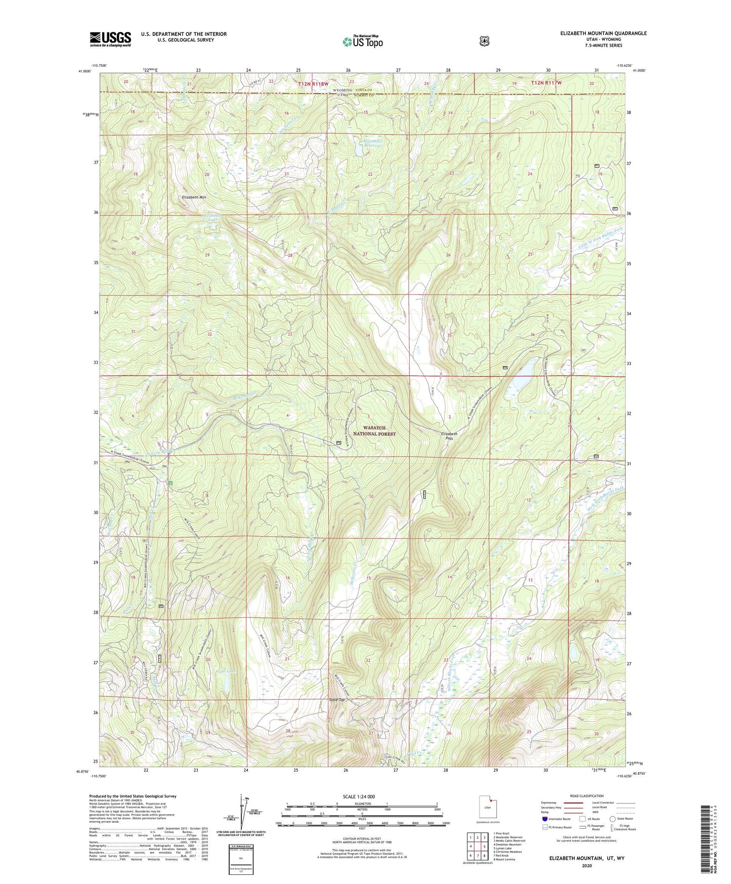
Elizabeth Mountain Utah US Topo Map
Couldn't load pickup availability
Also explore the Elizabeth Mountain Forest Service Topo of this same quad for updated USFS data
2023 topographic map quadrangle Elizabeth Mountain in the state of Utah. Scale: 1:24000. Based on the newly updated USGS 7.5' US Topo map series, this map is in the following counties: Summit, Uinta. The map contains contour data, water features, and other items you are used to seeing on USGS maps, but also has updated roads and other features. This is the next generation of topographic maps. Printed on high-quality waterproof paper with UV fade-resistant inks.
Quads adjacent to this one:
West: Deadman Mountain
Northwest: Pine Knoll
North: Moslander Reservoir
Northeast: Meeks Cabin Reservoir
East: Lyman Lake
Southeast: Mount Lovenia
South: Red Knob
Southwest: Christmas Meadows
Contains the following named places: Elizabeth Lake, Elizabeth Mountain, Elizabeth Pass, Fish Lake, Lost Dog Creek, Lym Lake, McKenzie Creek, Mill Creek Guard Station, Moslander Dam, Moslander Reservoir, North Fork Mill Creek, Plot Creek, Table Top, The Woodpile, Trail Creek