MyTopo
Deadman Mountain Utah US Topo Map
Couldn't load pickup availability
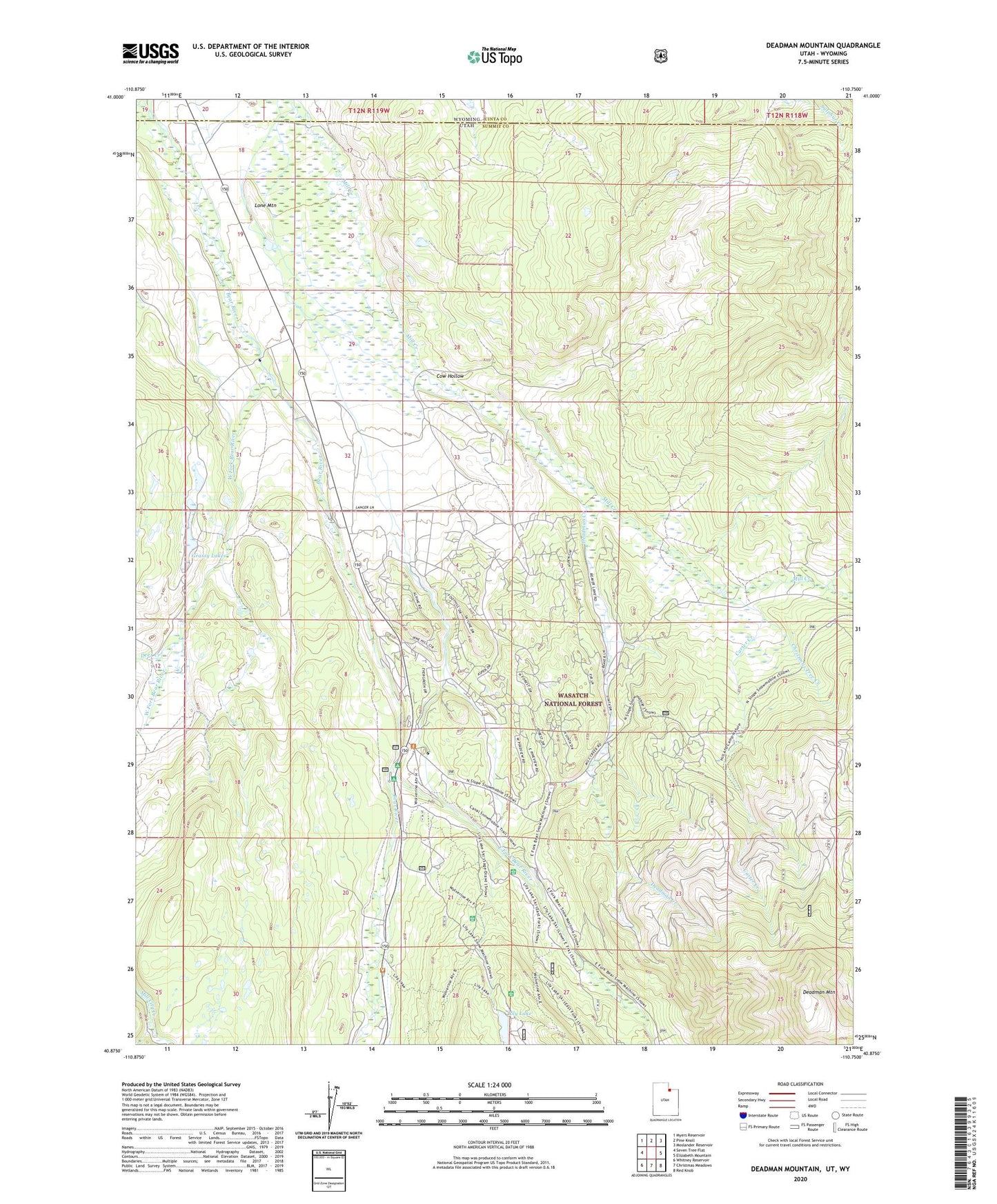
2020 topographic map quadrangle Deadman Mountain in the state of Utah. Scale: 1:24000. Based on the newly updated USGS 7.5' US Topo map series, this map is in the following counties: Summit, Uinta. The map contains contour data, water features, and other items you are used to seeing on USGS maps, but also has updated roads and other features. This is the next generation of topographic maps. Printed on high-quality waterproof paper with UV fade-resistant inks.
Quads adjacent to this one:
West: Seven Tree Flat
Northwest: Myers Reservoir
North: Pine Knoll
Northeast: Moslander Reservoir
East: Elizabeth Mountain
Southeast: Red Knob
South: Christmas Meadows
Southwest: Whitney Reservoir
Contains the following named places: Bear River Campground, Bear River Ranger Station, Burts-Miller Ranch, Carter Creek, Christmas Tree Creek, Cow Hollow, Deadman Creek, Deadman Mountain, Deer Creek, East Fork Bear River, East Fork Campground, Grassy Lake Dam, Grassy Lakes, Hill Air Force Base Recreation Camp, Hilliard Canal, Hilliard East Fork Canal, Hilliard Westside Canal, Hovarka Canal, Island Ranch, Lannon Ditch, Lily Lake, Lone Mountain, MacKays Cabin, West Fork Bear River