MyTopo
Moslander Reservoir Wyoming US Topo Map
Couldn't load pickup availability
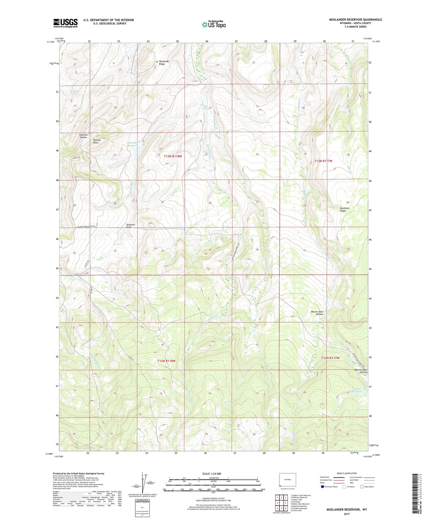
2021 topographic map quadrangle Moslander Reservoir in the state of Wyoming. Scale: 1:24000. Based on the newly updated USGS 7.5' US Topo map series, this map is in the following counties: Uinta. The map contains contour data, water features, and other items you are used to seeing on USGS maps, but also has updated roads and other features. This is the next generation of topographic maps. Printed on high-quality waterproof paper with UV fade-resistant inks.
Quads adjacent to this one:
West: Pine Knoll
Northwest: Sulphur Creek Reservoir
North: Piedmont Reservoir
Northeast: Hague Creek
East: Meeks Cabin Reservoir
Southeast: Lyman Lake
South: Elizabeth Mountain
Southwest: Deadman Mountain
This map covers the same area as the classic USGS quad with code o41110a6.
Contains the following named places: Beaver Dam Hollow, Cold Springs, Cold Springs Creek, Moslander Dam, Moslander Reservoir, Mumford Ridge, Seventeen Spring, Twenty Knoll, Twentyone Grove, Twomile Draw, Vacher Dam, Vacher Reservoir, Van Tassel Creek, Wash Supply Ditch, ZIP Code: 82930