MyTopo
Deer Range Point Utah US Topo Map
Couldn't load pickup availability
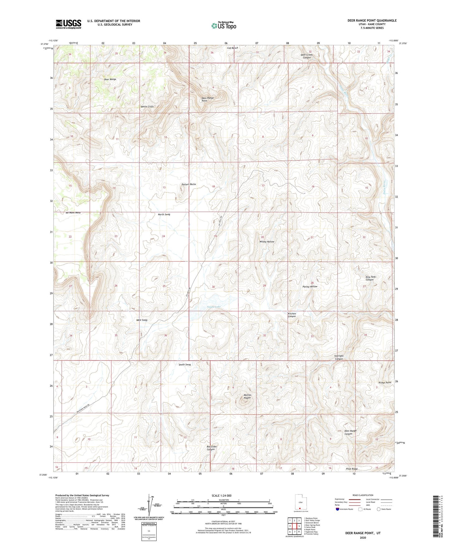
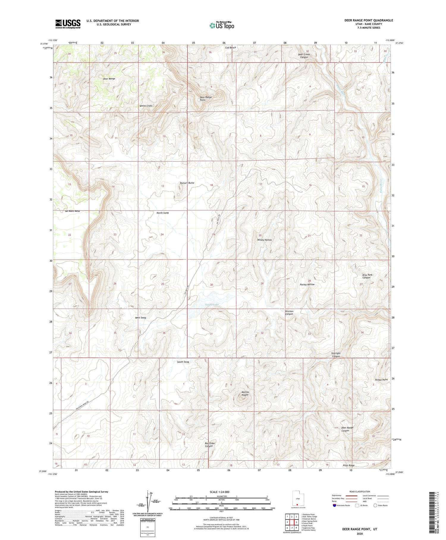
2020 topographic map quadrangle Deer Range Point in the state of Utah. Scale: 1:24000. Based on the newly updated USGS 7.5' US Topo map series, this map is in the following counties: Kane. The map contains contour data, water features, and other items you are used to seeing on USGS maps, but also has updated roads and other features. This is the next generation of topographic maps. Printed on high-quality waterproof paper with UV fade-resistant inks.
Quads adjacent to this one:
West: Deer Spring Point
Northwest: Rainbow Point
North: Bull Valley Gorge
Northeast: Slickrock Bench
East: Calico Peak
Southeast: Fivemile Valley
South: Eightmile Pass
Southwest: Nephi Point
Contains the following named places: Cad Bench, Deer Creek Canyon, Deer Range Point, Deer Trails, Drip Tank Canyon, Kirbys Point, Mollies Nipple, Nipple Lake, Nipple Ranch, No Mans Mesa, North Swag, Parley Hollow, Pilot Ridge, Potters Butte, Snake Creek, South Swag, Starlight Canyon, West Swag, White Cliffs, Wilsey Hollow