MyTopo
Fivemile Valley Utah US Topo Map
Couldn't load pickup availability
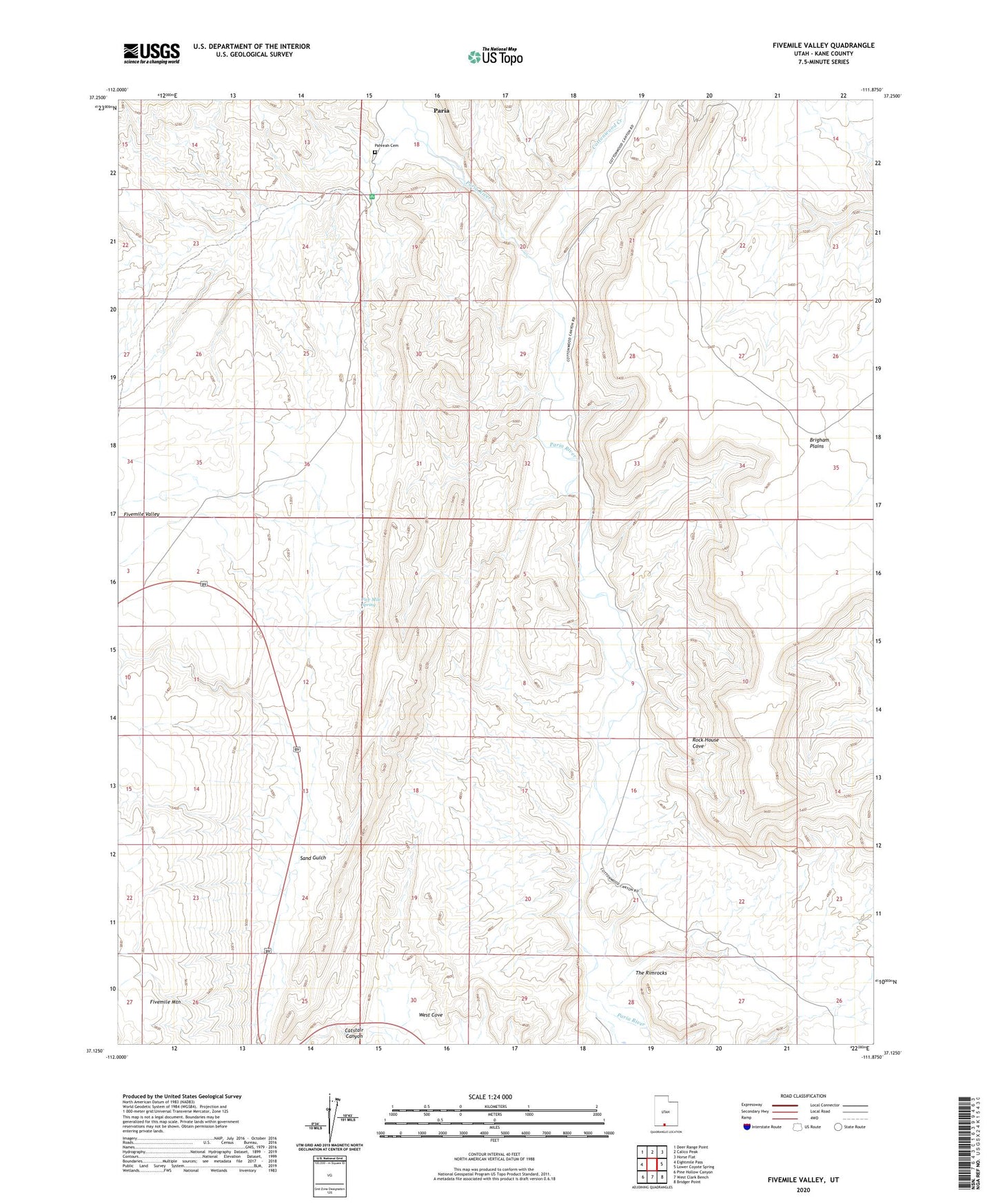
2023 topographic map quadrangle Fivemile Valley in the state of Utah. Scale: 1:24000. Based on the newly updated USGS 7.5' US Topo map series, this map is in the following counties: Kane. The map contains contour data, water features, and other items you are used to seeing on USGS maps, but also has updated roads and other features. This is the next generation of topographic maps. Printed on high-quality waterproof paper with UV fade-resistant inks.
Quads adjacent to this one:
West: Eightmile Pass
Northwest: Deer Range Point
North: Calico Peak
Northeast: Horse Flat
East: Lower Coyote Spring
Southeast: Bridger Point
South: West Clark Bench
Southwest: Pine Hollow Canyon
This map covers the same area as the classic USGS quad with code o37111b8.
Contains the following named places: Brigham Plains, Catstair Canyon, Cottonwood Creek, Five Mile Spring, Hattie Green Mine, Pahreah Cemetery, Paria, Rock House Cove, Sand Gulch