MyTopo
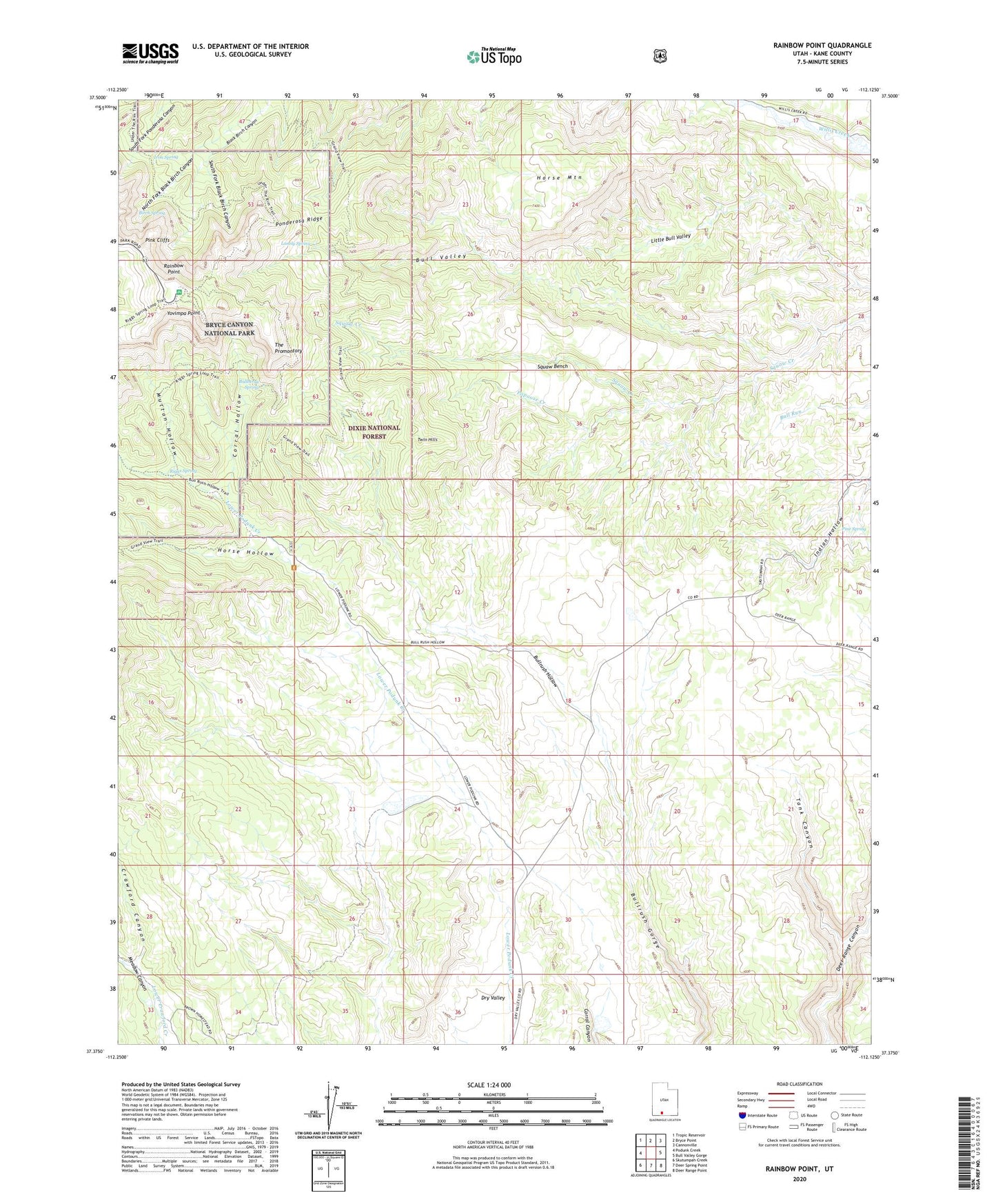
Rainbow Point Utah US Topo Map
Couldn't load pickup availability
Also explore the Rainbow Point Forest Service Topo of this same quad for updated USFS data
2023 topographic map quadrangle Rainbow Point in the state of Utah. Scale: 1:24000. Based on the newly updated USGS 7.5' US Topo map series, this map is in the following counties: Kane. The map contains contour data, water features, and other items you are used to seeing on USGS maps, but also has updated roads and other features. This is the next generation of topographic maps. Printed on high-quality waterproof paper with UV fade-resistant inks.
Quads adjacent to this one:
West: Podunk Creek
Northwest: Tropic Reservoir
North: Bryce Point
Northeast: Cannonville
East: Bull Valley Gorge
Southeast: Deer Range Point
South: Deer Spring Point
Southwest: Skutumpah Creek
This map covers the same area as the classic USGS quad with code o37112d2.
Contains the following named places: Birch Spring, Bristlecone Loop Trail, Bullberry Spring, Bullrush Hollow, Corral Hollow, Crawford Canyon, Dry Valley, Horse Hollow, Horse Mountain, Iron Spring, Lonely Park, Lonely Spring, Lower Crawford Creek, Mutton Hollow, North Fork Black Birch Canyon, Papoose Creek, Pine Spring, Ponderosa Ridge, Rainbow Point, Rainbow Point Overlook, Riggs Spring, Riggs Spring Loop Trail, South Fork Black Birch Canyon, Squaw Bench, Squaw Creek, Swallow Park Ranch, Tank Canyon, The Promontory, Twin Hills, Yovimpa Point, Yovimpa Point Overlook