MyTopo
Calico Peak Utah US Topo Map
Couldn't load pickup availability
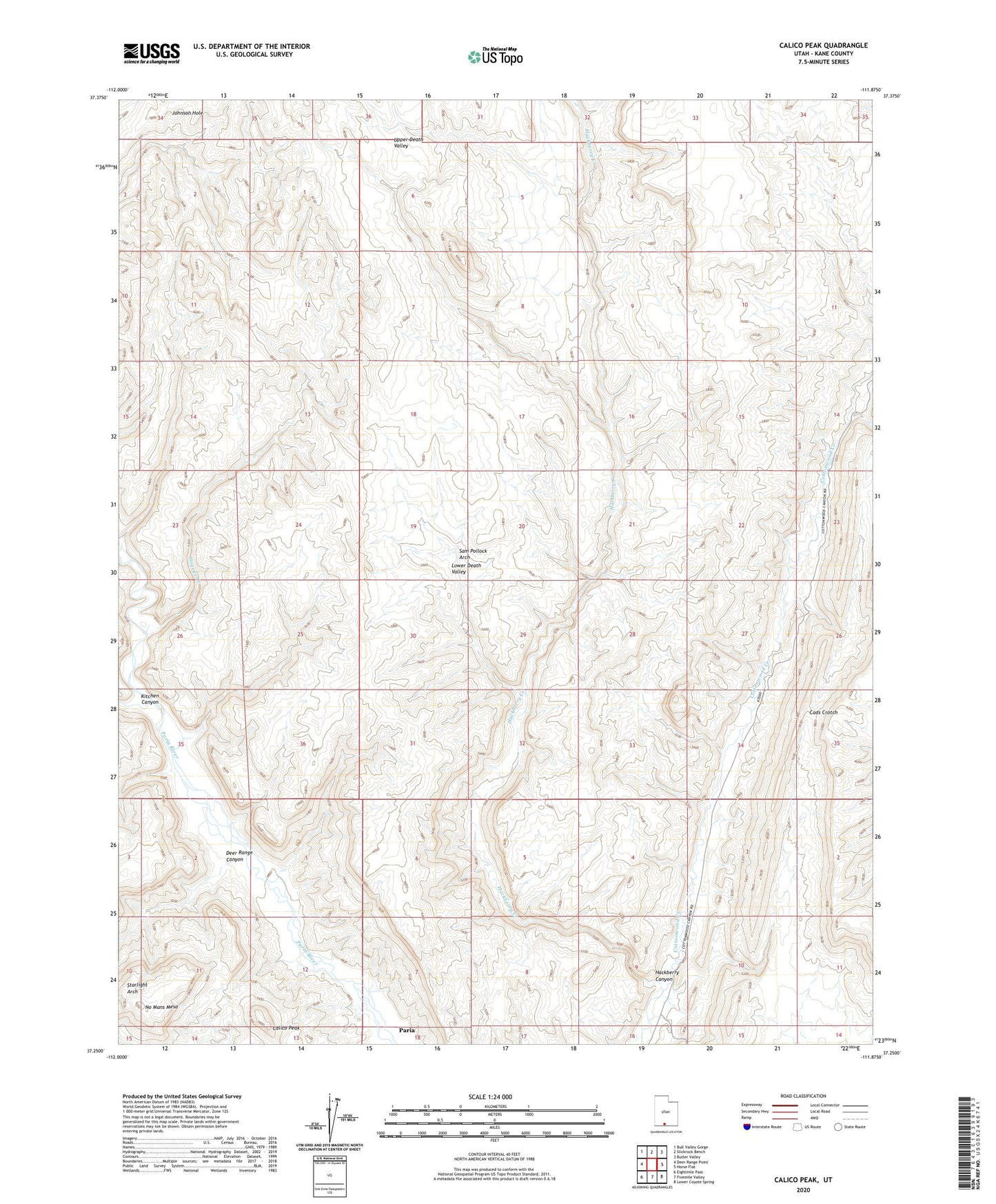
2023 topographic map quadrangle Calico Peak in the state of Utah. Scale: 1:24000. Based on the newly updated USGS 7.5' US Topo map series, this map is in the following counties: Kane. The map contains contour data, water features, and other items you are used to seeing on USGS maps, but also has updated roads and other features. This is the next generation of topographic maps. Printed on high-quality waterproof paper with UV fade-resistant inks.
Quads adjacent to this one:
West: Deer Range Point
Northwest: Bull Valley Gorge
North: Slickrock Bench
Northeast: Butler Valley
East: Horse Flat
Southeast: Lower Coyote Spring
South: Fivemile Valley
Southwest: Eightmile Pass
This map covers the same area as the classic USGS quad with code o37111c8.
Contains the following named places: Calico Peak, Deer Range Canyon, Hackberry Canyon, Hackberry Creek, Hogeye Creek, Kane County, Kitchen Canyon, Lower Death Valley, No Mans Mesa, Sam Pollock Arch, Starlight Arch