MyTopo
Eightmile Pass Utah US Topo Map
Couldn't load pickup availability
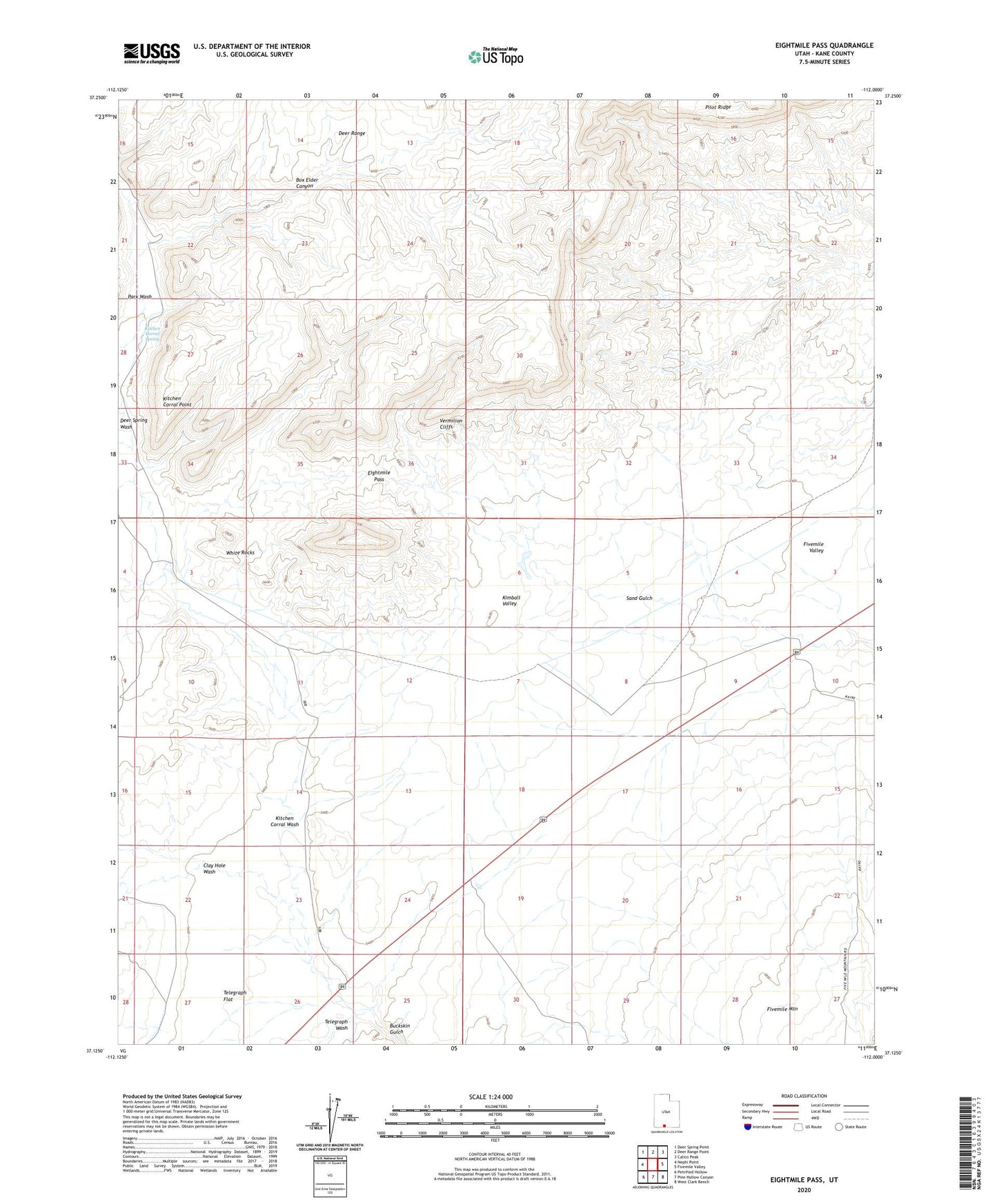
2023 topographic map quadrangle Eightmile Pass in the state of Utah. Scale: 1:24000. Based on the newly updated USGS 7.5' US Topo map series, this map is in the following counties: Kane. The map contains contour data, water features, and other items you are used to seeing on USGS maps, but also has updated roads and other features. This is the next generation of topographic maps. Printed on high-quality waterproof paper with UV fade-resistant inks.
Quads adjacent to this one:
West: Nephi Point
Northwest: Deer Spring Point
North: Deer Range Point
Northeast: Calico Peak
East: Fivemile Valley
Southeast: West Clark Bench
South: Pine Hollow Canyon
Southwest: Petrified Hollow
This map covers the same area as the classic USGS quad with code o37112b1.
Contains the following named places: Box Elder Canyon, Clay Hole Wash, Deer Range, Deer Spring Wash, Eightmile Pass, Kimball Valley, King Mine, Kitchen Corral Point, Kitchen Corral Spring, Kitchen Corral Wash, Park Wash, Telegraph Flat, Telegraph Wash, White Rocks