MyTopo
Dinosaur Quarry Utah US Topo Map
Couldn't load pickup availability
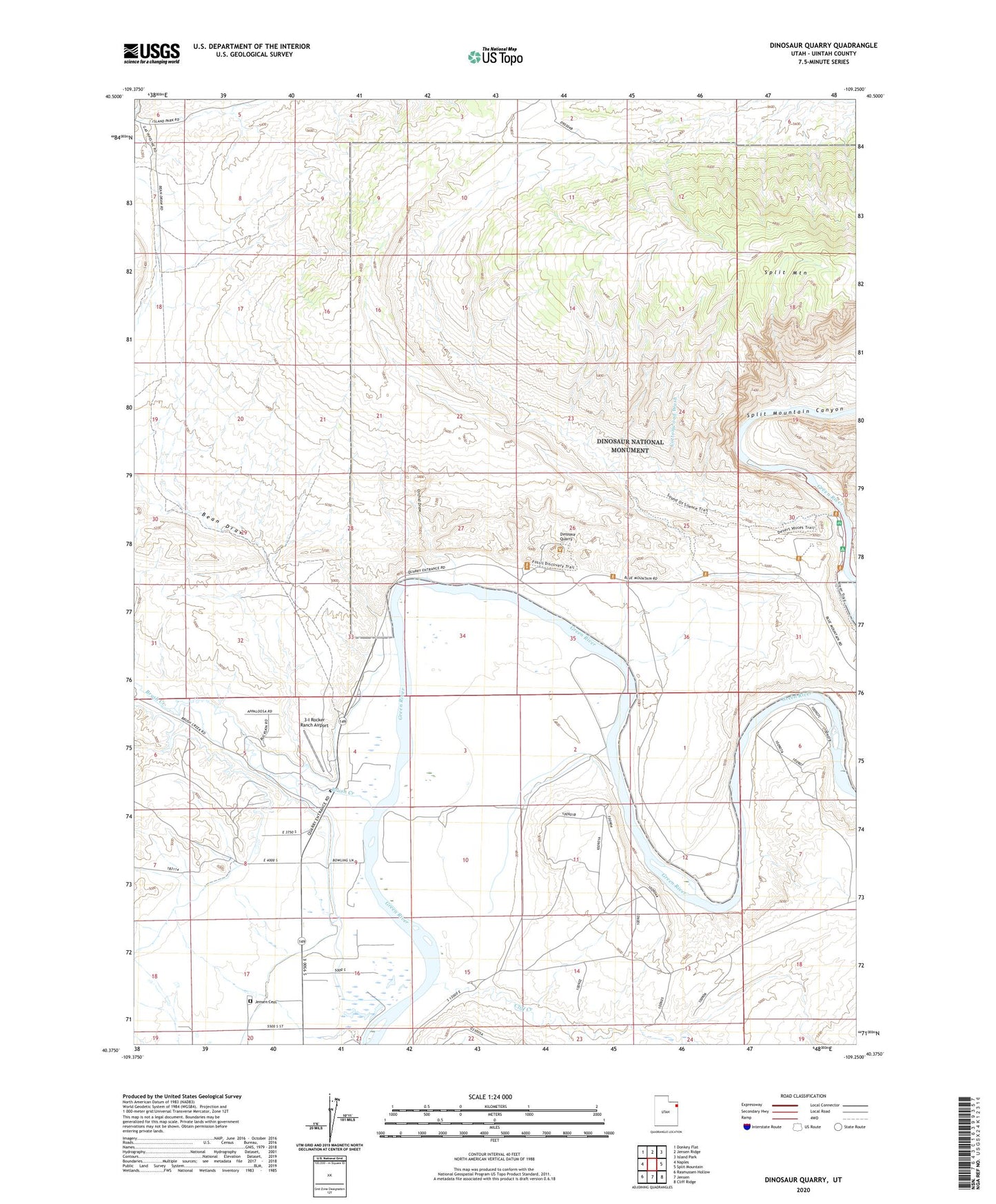
2023 topographic map quadrangle Dinosaur Quarry in the state of Utah. Scale: 1:24000. Based on the newly updated USGS 7.5' US Topo map series, this map is in the following counties: Uintah. The map contains contour data, water features, and other items you are used to seeing on USGS maps, but also has updated roads and other features. This is the next generation of topographic maps. Printed on high-quality waterproof paper with UV fade-resistant inks.
Quads adjacent to this one:
West: Naples
Northwest: Donkey Flat
North: Jensen Ridge
Northeast: Island Park
East: Split Mountain
Southeast: Cliff Ridge
South: Jensen
Southwest: Rasmussen Hollow
This map covers the same area as the classic USGS quad with code o40109d3.
Contains the following named places: 3-I Rocker Ranch Airport, Bean Draw, Brush Creek, Cliff Creek, Cottonwood Wash, Dinosaur Quarry, Escalante Crossing, Jensen Cemetery, Orchid Draw, Red Rock Nature Trail, Red Wash, Split Mountain Canyon, Split Mountain Gorge Campground