MyTopo
Cliff Ridge Utah US Topo Map
Couldn't load pickup availability
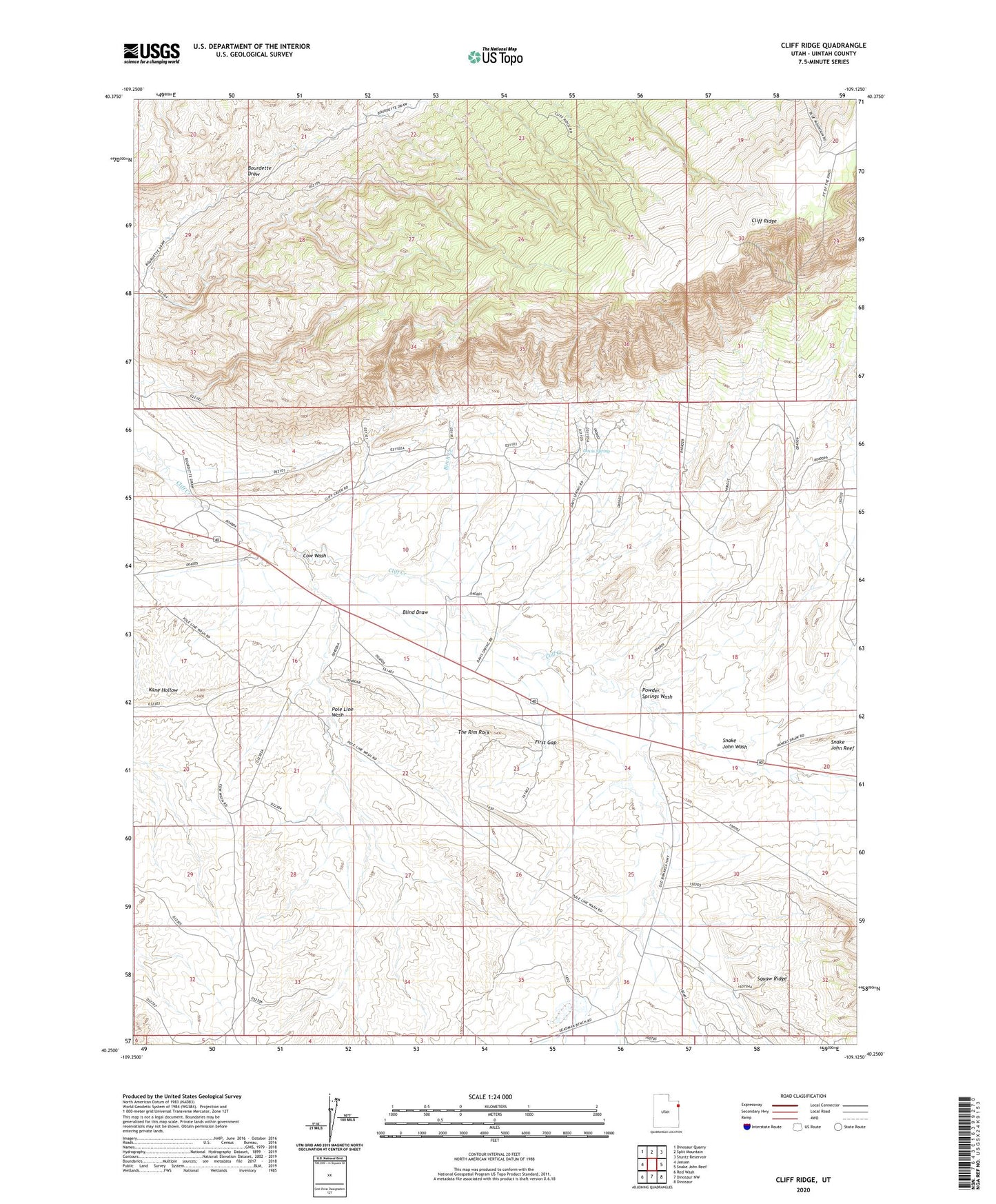
2023 topographic map quadrangle Cliff Ridge in the state of Utah. Scale: 1:24000. Based on the newly updated USGS 7.5' US Topo map series, this map is in the following counties: Uintah. The map contains contour data, water features, and other items you are used to seeing on USGS maps, but also has updated roads and other features. This is the next generation of topographic maps. Printed on high-quality waterproof paper with UV fade-resistant inks.
Quads adjacent to this one:
West: Jensen
Northwest: Dinosaur Quarry
North: Split Mountain
Northeast: Stuntz Reservoir
East: Snake John Reef
Southeast: Dinosaur
South: Dinosaur NW
Southwest: Red Wash
This map covers the same area as the classic USGS quad with code o40109c2.
Contains the following named places: Birch Creek, Blind Draw, Bourdette Draw, Cliff Ridge, Cow Wash, Cow Wash Reservoir, Davis Spring, First Gap, Musket Shot Springs, Pole Line Wash, Powder Springs Wash, Snake John Wash, The Rim Rock, ZIP Code: 84035