MyTopo
Dry Canyon Utah US Topo Map
Couldn't load pickup availability
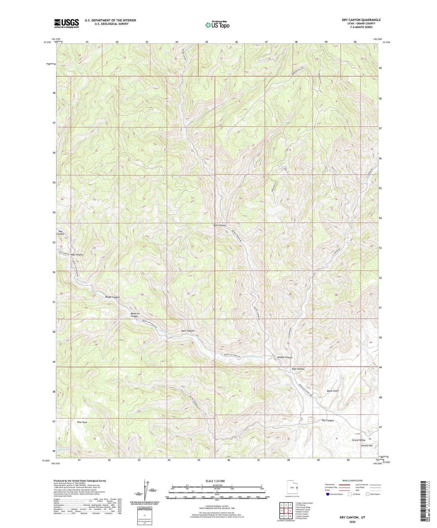
2023 topographic map quadrangle Dry Canyon in the state of Utah. Scale: 1:24000. Based on the newly updated USGS 7.5' US Topo map series, this map is in the following counties: Grand. The map contains contour data, water features, and other items you are used to seeing on USGS maps, but also has updated roads and other features. This is the next generation of topographic maps. Printed on high-quality waterproof paper with UV fade-resistant inks.
Quads adjacent to this one:
West: Preacher Canyon
Northwest: Cedar Camp Canyon
North: P R Spring
Northeast: San Arroyo Ridge
East: Bryson Canyon
Southeast: Harley Dome
South: Antone Canyon
Southwest: Flume Canyon
This map covers the same area as the classic USGS quad with code o39109c3.
Contains the following named places: Bryson Canyon Gas Field, Bull Canyon, Dark Canyon, Dry Canyon, East Canyon, Hay Canyon, Maverick Canyon, Middle Canyon, Pear Park, Pear Park Gas Field, Potato Hill, Robidoux Compressor Station, Robidoux Inscription, Rough Canyon, Westwater Gas Field