MyTopo
Preacher Canyon Utah US Topo Map
Couldn't load pickup availability
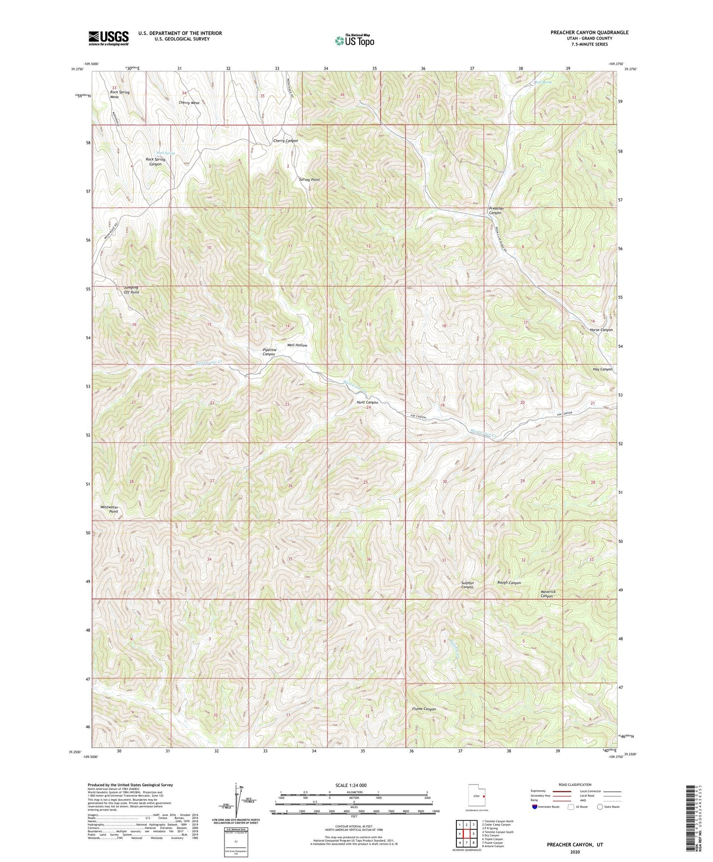
2023 topographic map quadrangle Preacher Canyon in the state of Utah. Scale: 1:24000. Based on the newly updated USGS 7.5' US Topo map series, this map is in the following counties: Grand. The map contains contour data, water features, and other items you are used to seeing on USGS maps, but also has updated roads and other features. This is the next generation of topographic maps. Printed on high-quality waterproof paper with UV fade-resistant inks.
Quads adjacent to this one:
West: Tenmile Canyon South
Northwest: Tenmile Canyon North
North: Cedar Camp Canyon
Northeast: P R Spring
East: Dry Canyon
Southeast: Antone Canyon
South: Flume Canyon
Southwest: Tepee Canyon
This map covers the same area as the classic USGS quad with code o39109c4.
Contains the following named places: Diamond Ridge Gas Field, Horse Canyon, Hunt Canyon, Jumping Off Point, Pipeline Canyon, Preacher Canyon, Red Spring, Rock Spring, Survey Point, Well Hollow, Westwater Point