MyTopo
Cedar Camp Canyon Utah US Topo Map
Couldn't load pickup availability
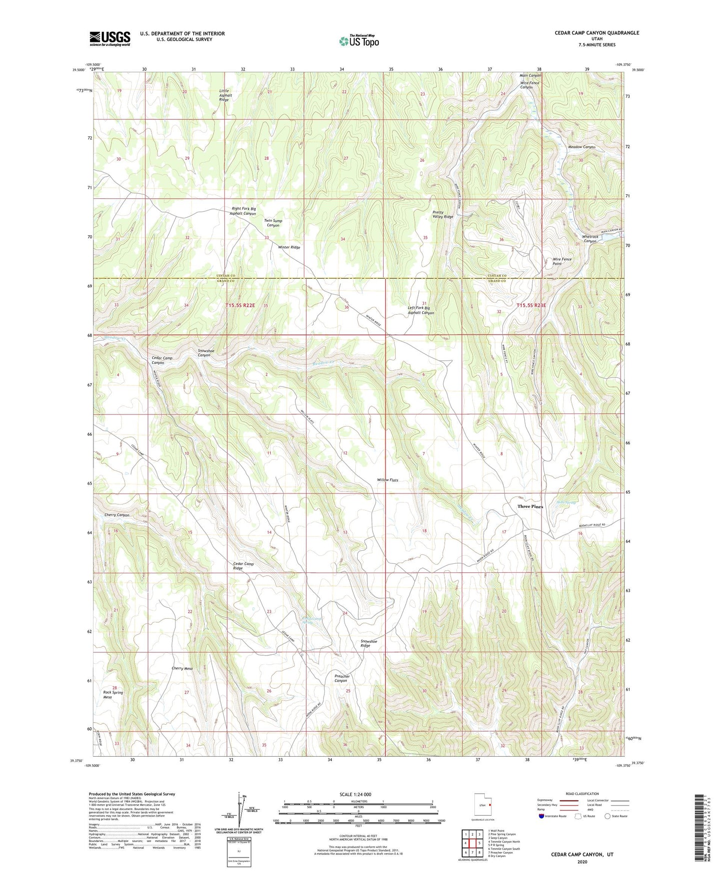
2023 topographic map quadrangle Cedar Camp Canyon in the state of Utah. Scale: 1:24000. Based on the newly updated USGS 7.5' US Topo map series, this map is in the following counties: Grand, Uintah. The map contains contour data, water features, and other items you are used to seeing on USGS maps, but also has updated roads and other features. This is the next generation of topographic maps. Printed on high-quality waterproof paper with UV fade-resistant inks.
Quads adjacent to this one:
West: Tenmile Canyon North
Northwest: Wolf Point
North: Pine Spring Canyon
Northeast: Seep Canyon
East: P R Spring
Southeast: Dry Canyon
South: Preacher Canyon
Southwest: Tenmile Canyon South
This map covers the same area as the classic USGS quad with code o39109d4.
Contains the following named places: Cedar Camp Canyon, Cedar Camp Ridge, Cedar Camp Spring, Cherry Canyon, Cherry Mesa, Fence Canyon Gas Field, Little Asphalt Ridge, Meadow Canyon, Pretty Valley Ridge, Shale Spring, Snowshoe Canyon, Snowshoe Ridge, Three Pines, Whetrock Canyon, Willow Flats, Wire Fence Canyon, Wire Fence Point