MyTopo
Dry Lakes Peak Utah US Topo Map
Couldn't load pickup availability
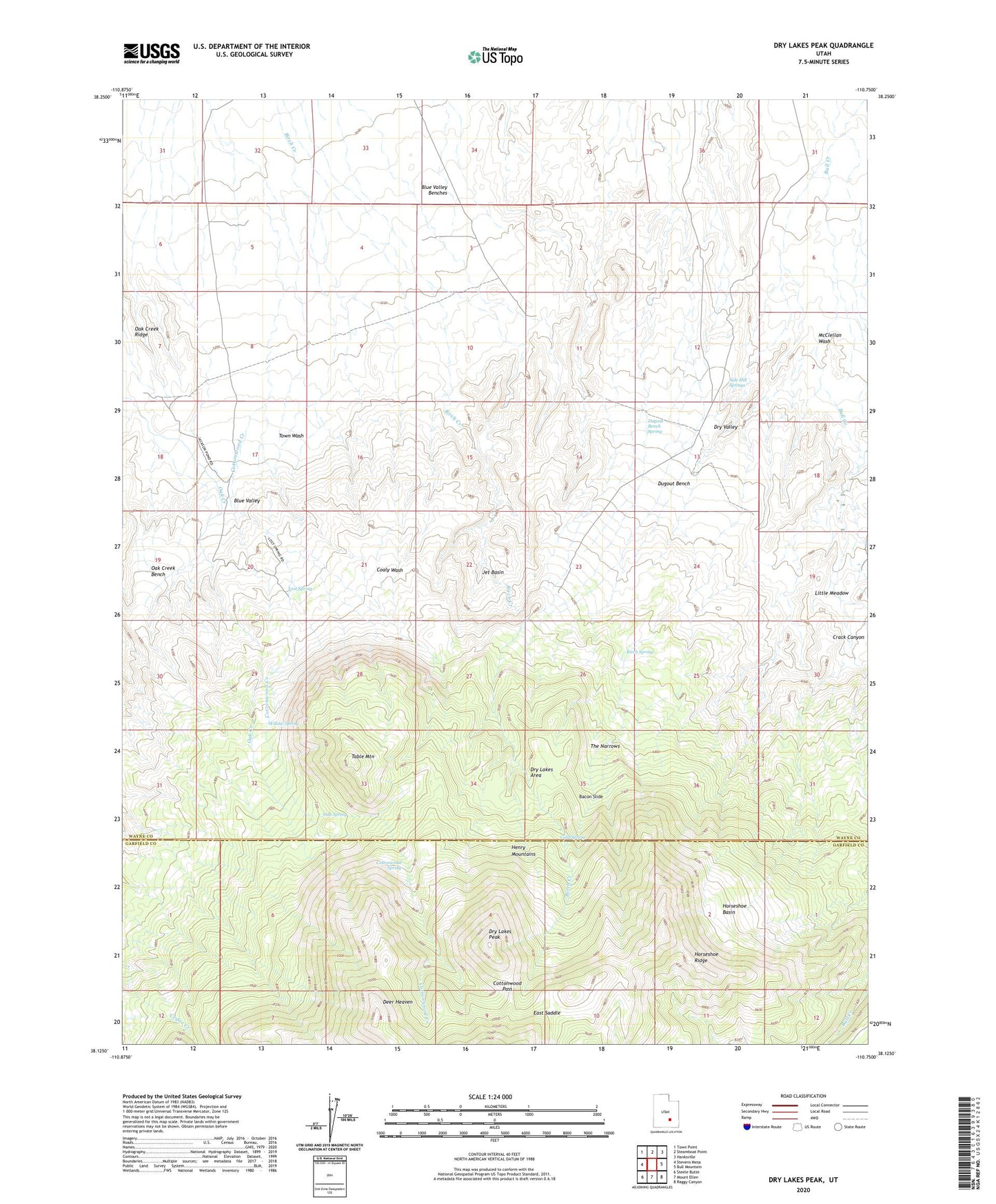
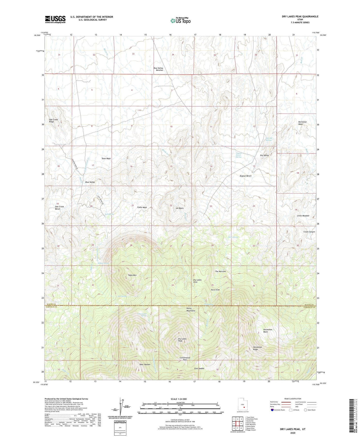
2020 topographic map quadrangle Dry Lakes Peak in the state of Utah. Scale: 1:24000. Based on the newly updated USGS 7.5' US Topo map series, this map is in the following counties: Wayne, Garfield. The map contains contour data, water features, and other items you are used to seeing on USGS maps, but also has updated roads and other features. This is the next generation of topographic maps. Printed on high-quality waterproof paper with UV fade-resistant inks.
Quads adjacent to this one:
West: Stevens Mesa
Northwest: Town Point
North: Steamboat Point
Northeast: Hanksville
East: Bull Mountain
Southeast: Raggy Canyon
South: Mount Ellen
Southwest: Steele Butte
Contains the following named places: Bacon Slide, Birch Spring, Cold Spring, Cottonwood Pass, Cottonwood Spring, Deer Heaven, Dry Lakes Area, Dry Lakes Peak, Dugout Bench, Dugout Bench Spring, East Saddle, Horseshoe Basin, Horseshoe Ridge, Jet Basin, Little Meadow, Lost Spring, McClellan Wash, Oak Creek Bench, Oak Spring, Rock Corral, Side Hill Springs, Table Mountain, The Narrows, Willow Spring