MyTopo
Steele Butte Utah US Topo Map
Couldn't load pickup availability
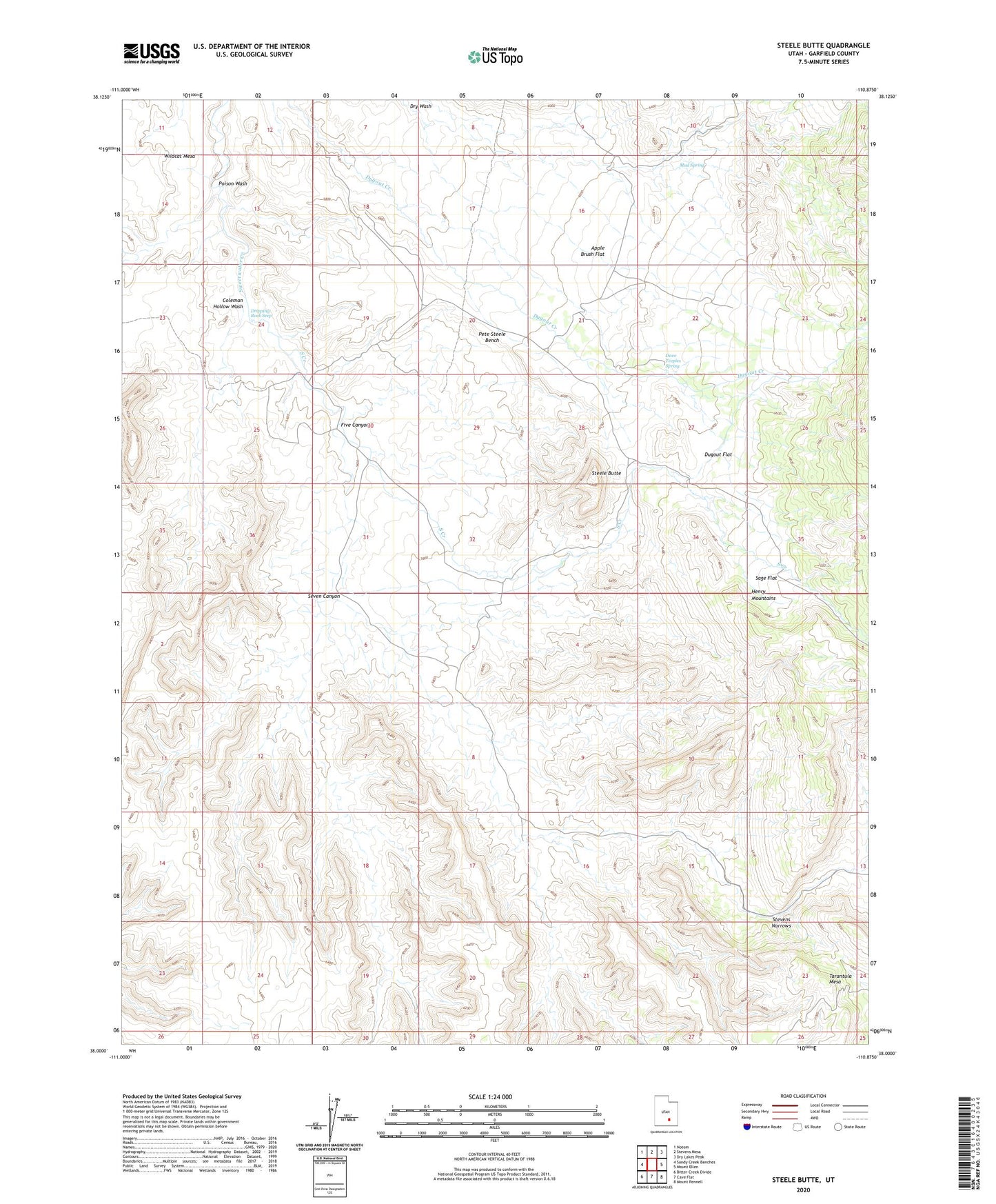
2023 topographic map quadrangle Steele Butte in the state of Utah. Scale: 1:24000. Based on the newly updated USGS 7.5' US Topo map series, this map is in the following counties: Garfield. The map contains contour data, water features, and other items you are used to seeing on USGS maps, but also has updated roads and other features. This is the next generation of topographic maps. Printed on high-quality waterproof paper with UV fade-resistant inks.
Quads adjacent to this one:
West: Sandy Creek Benches
Northwest: Notom
North: Stevens Mesa
Northeast: Dry Lakes Peak
East: Mount Ellen
Southeast: Mount Pennell
South: Cave Flat
Southwest: Bitter Creek Divide
This map covers the same area as the classic USGS quad with code o38110a8.
Contains the following named places: Apple Brush Flat, Coleman Hollow Wash, Dave Teeples Spring, Dripping Rock Seep, Dugout Flat, Five Canyon, King Ranch, Mud Spring, Pete Steele Bench, Poison Wash, Sage Flat, Seven Canyon, South Creek, Steele Butte, Stevens Narrows, Tarantula Mesa