MyTopo
East Canyon Reservoir Utah US Topo Map
Couldn't load pickup availability
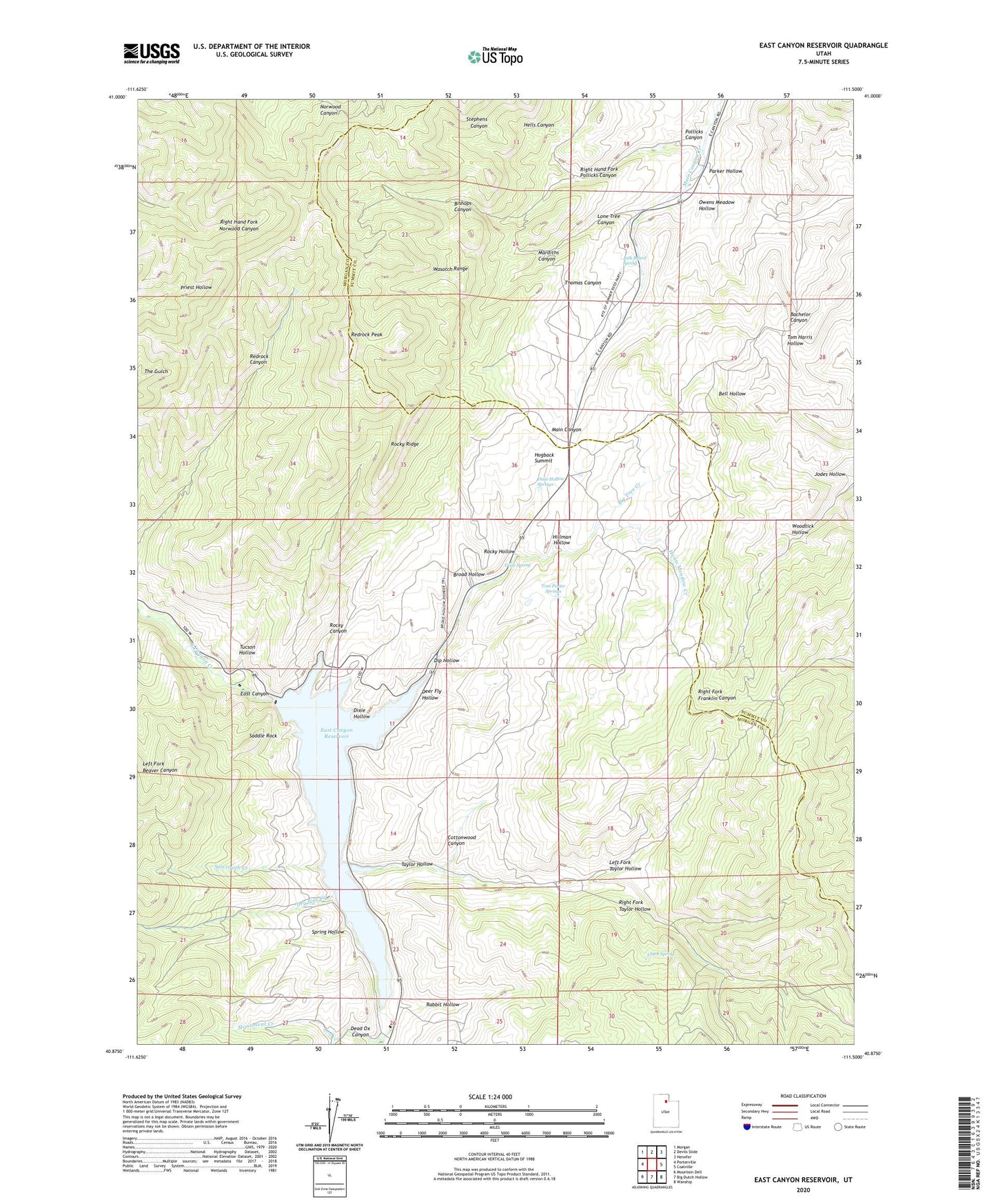
2020 topographic map quadrangle East Canyon Reservoir in the state of Utah. Scale: 1:24000. Based on the newly updated USGS 7.5' US Topo map series, this map is in the following counties: Morgan, Summit. The map contains contour data, water features, and other items you are used to seeing on USGS maps, but also has updated roads and other features. This is the next generation of topographic maps. Printed on high-quality waterproof paper with UV fade-resistant inks.
Quads adjacent to this one:
West: Porterville
Northwest: Morgan
North: Devils Slide
Northeast: Henefer
East: Coalville
Southeast: Wanship
South: Big Dutch Hollow
Southwest: Mountain Dell
Contains the following named places: Big Tree Creek, Bishops Canyon, Broad Hollow, Clark Spring, Cottonwood Canyon, Dead Ox Canyon, Deer Fly Hollow, Dip Hollow, Dixie Hollow, Dixie Hollow Springs, Dixie Spring, Dry Pine Creek, East Canyon Campground, East Canyon Dam, East Canyon Reservoir, East Canyon State Park, Grants Grave, Hells Canyon, Hillman Hollow, Hogback Summit, Hunts Meadow Creek, Jack Beard Spring, Jodes Hollow, Left Fork Taylor Hollow, Lone Tree Campsite, Lone Tree Canyon, Mardiths Canyon, Monument Creek, Owens Meadow Hollow, Parker Hollow, Pollicks Canyon, Rabbit Hollow, Redrock Peak, Right Fork Taylor Hollow, Right Hand Fork Pollicks Canyon, Rocky Canyon, Rocky Hollow, Rocky Ridge, Route of Donner-Reed Party and Mormon Pioneers, Saddle Rock, Sawtooth Creek, Site of Dixie Hollow Pony Express Station, Spring Hollow, Taylor Hollow, Thomas Canyon, Tom Porter Springs, Tucson Hollow, Woodtick Hollow, ZIP Code: 84033