MyTopo
Wanship Utah US Topo Map
Couldn't load pickup availability
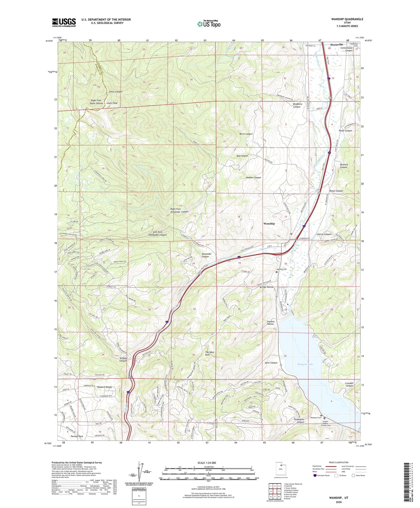
2023 topographic map quadrangle Wanship in the state of Utah. Scale: 1:24000. Based on the newly updated USGS 7.5' US Topo map series, this map is in the following counties: Summit, Morgan. The map contains contour data, water features, and other items you are used to seeing on USGS maps, but also has updated roads and other features. This is the next generation of topographic maps. Printed on high-quality waterproof paper with UV fade-resistant inks.
Quads adjacent to this one:
West: Big Dutch Hollow
Northwest: East Canyon Reservoir
North: Coalville
Northeast: Turner Hollow
East: Crandall Canyon
Southeast: Kamas
South: Park City East
Southwest: Park City West
This map covers the same area as the classic USGS quad with code o40111g4.
Contains the following named places: Alexander Canyon, Area A Recreation Site, Area B Recreation Site, Area D Recreation Site, Big Canyon, Birch Canyon, Bradbury Canyon, Bridge Hollow, Cherry Canyon, Cooper - Hughes - Vickory Cemetery, Cottonwood Canyon, Cottonwood Creek, Crandall Canyon, Dunford Canyon, Hadden Canyon, Hixon Canyon, Hoytsville, Kent Canyon, Left Fork Alexander Canyon, Lewis Peak, Lost Creek, North Summit EMS Ambulance, North Summit Fire District Station 23 Wanship, Pecks Canyon, Pine Creek, Right Fork Alexander Canyon, Rockport Campground, Rockport Cemetery, Rockport Lake, Rockport State Park, Seymour / Davis Cemetery, Silver Creek, Stevens Hollow, The Church of Jesus Christ of Latter Day Saints, Threemile Canyon, Tollgate Canyon, Union Pacific Rail Trail, Wanship, Wanship Cemetery, Wanship Census Designated Place, Wanship Dam