
MyTopo
Elk Park Utah US Topo Map
Couldn't load pickup availability
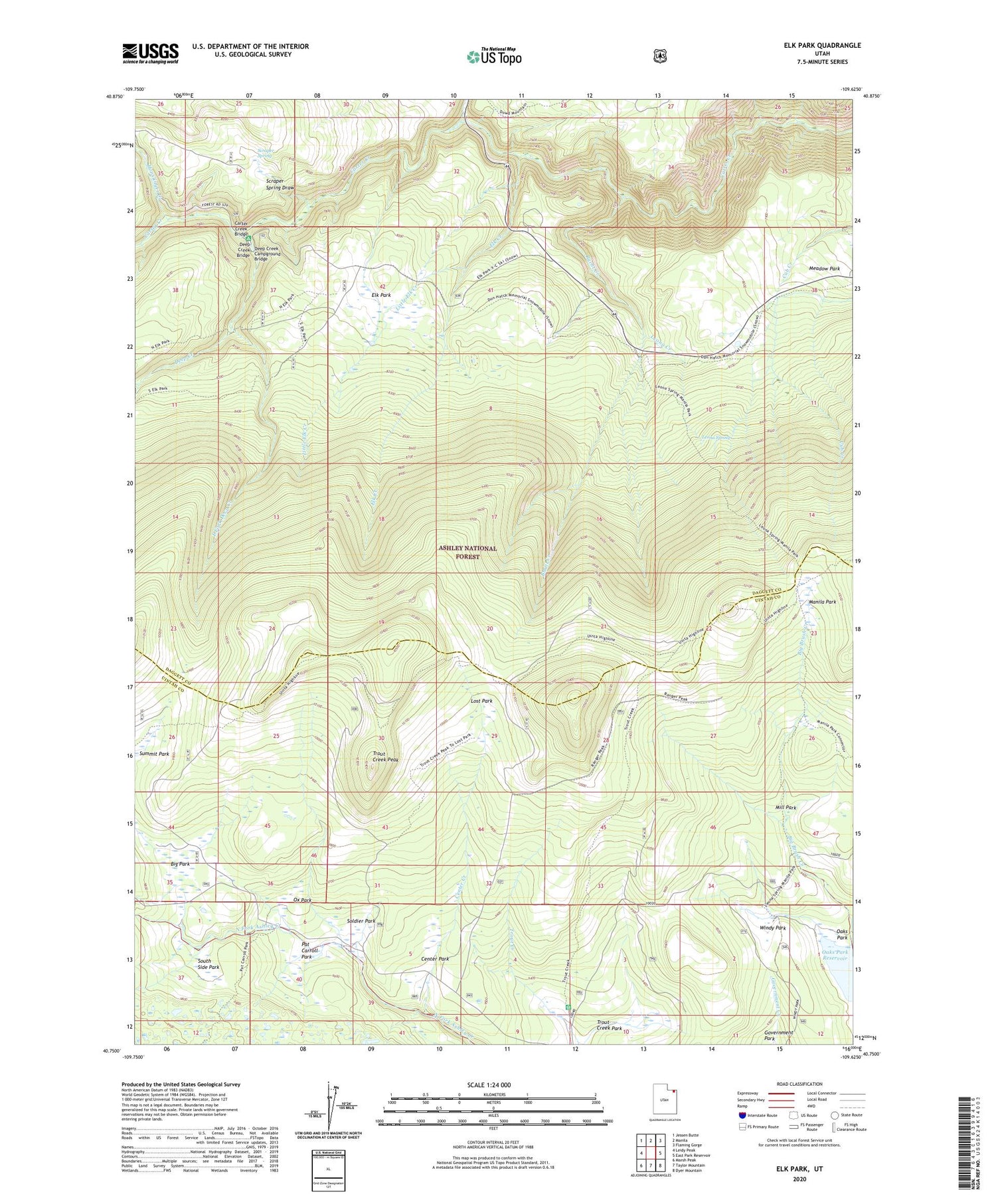
2020 topographic map quadrangle Elk Park in the state of Utah. Scale: 1:24000. Based on the newly updated USGS 7.5' US Topo map series, this map is in the following counties: Daggett, Uintah. The map contains contour data, water features, and other items you are used to seeing on USGS maps, but also has updated roads and other features. This is the next generation of topographic maps. Printed on high-quality waterproof paper with UV fade-resistant inks.
Quads adjacent to this one:
West: Leidy Peak
Northwest: Jessen Butte
North: Manila
Northeast: Flaming Gorge
East: East Park Reservoir
Southeast: Dyer Mountain
South: Taylor Mountain
Southwest: Marsh Peak
Contains the following named places: Big Park, Burnt Creek, Carter Creek Bridge, Center Creek, Center Park, Deep Creek, Deep Creek Bridge, Deep Creek Campground, Deep Creek Campground Bridge, Dowd Creek, East Fork Deep Creek, Elk Creek, Elk Park, Honslinger Creek, Leona Creek, Leona Spring, Little Elk Creek, Lost Park, Manila Park, Mill Park, Oaks Park, Ox Park, Pat Carroll Park, Scraper Spring, Scraper Spring Draw, Soldier Park, South Side Park, Trout Creek Guard Station, Trout Creek Park, Trout Creek Peak, Uinta Highline Trail, Windy Park


