MyTopo
Dyer Mountain Utah US Topo Map
Couldn't load pickup availability
Also explore the Dyer Mountain Forest Service Topo of this same quad for updated USFS data
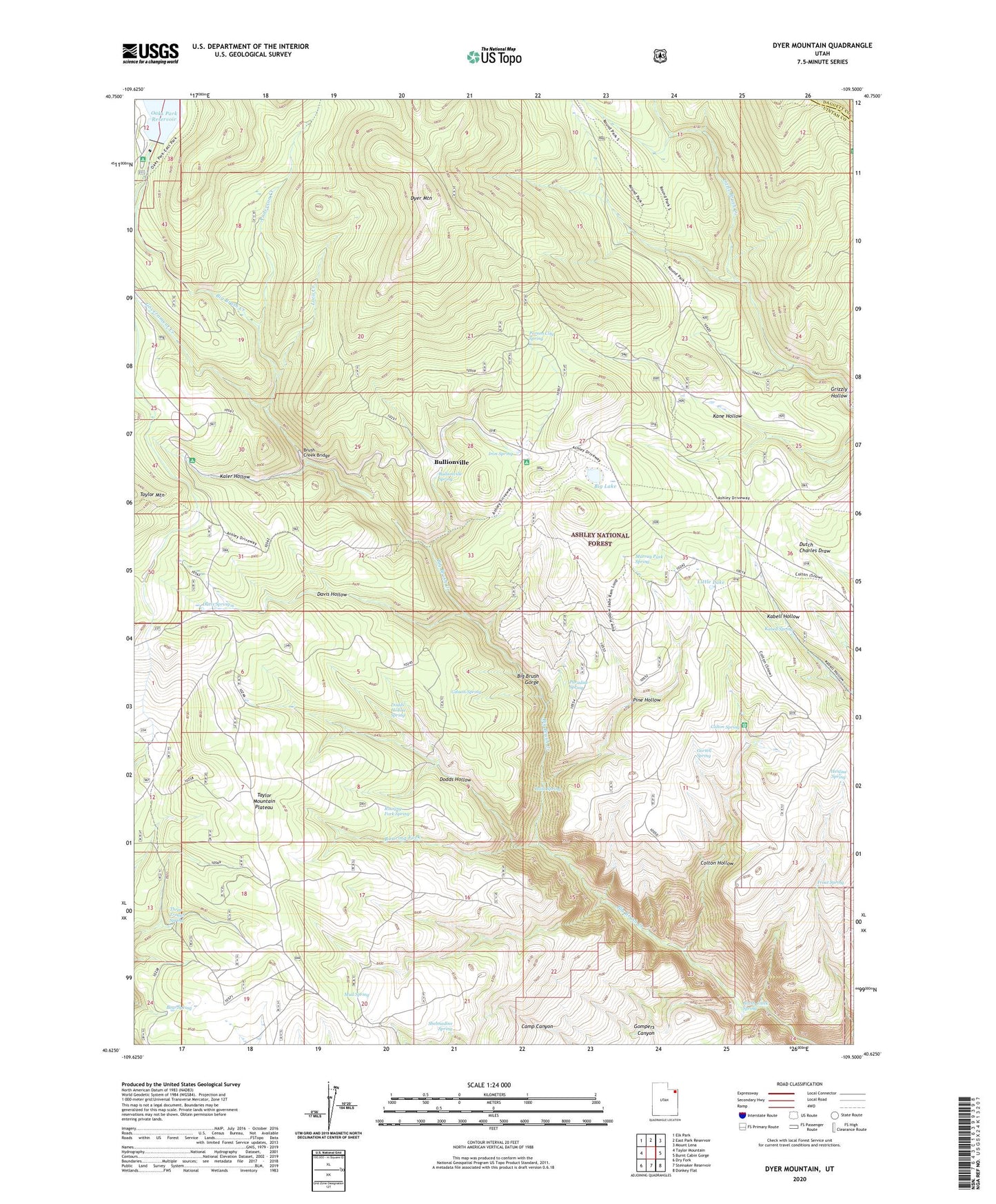
2023 topographic map quadrangle Dyer Mountain in the state of Utah. Scale: 1:24000. Based on the newly updated USGS 7.5' US Topo map series, this map is in the following counties: Uintah, Daggett. The map contains contour data, water features, and other items you are used to seeing on USGS maps, but also has updated roads and other features. This is the next generation of topographic maps. Printed on high-quality waterproof paper with UV fade-resistant inks.
Quads adjacent to this one:
West: Taylor Mountain
Northwest: Elk Park
North: East Park Reservoir
Northeast: Mount Lena
East: Burnt Cabin Gorge
Southeast: Donkey Flat
South: Steinaker Reservoir
Southwest: Dry Fork
This map covers the same area as the classic USGS quad with code o40109f5.
Contains the following named places: Anderson Creek, Bear Spring, Big Lake, Brush Creek Bridge, Brush Creek Canyon Overlook, Brush Creek Corral, Brush Creek Spring, Bullionville, Bullionville Spring, Colton Hollow, Colton Ranger Station, Colton Spring, Davis Hollow, Davis Spring, Dodds Hollow, Dodds Hollow Spring, Dyer Mines, Dyer Mountain, Gartell Spring, Gibson Spring, Gompers Canyon, Government Creek, Grizzly Hollow, Henline Spring, Iron Spring, Iron Spring Camp, Iron Springs Campground, Kabell Spring, Kaler Hollow, Kaler Hollow Campground, Little Lake, Loco Creek, Mud Spring, Murray Park Spring, Oaks Park Campground, Oaks Park Dam, Paradise Spring, Parson City Spring, Pine Hollow, Point Spring, Roaring Fork, Roaring Fork Spring, Shelmadine Spring, Taylor Mountain Plateau, Three Trough Spring, Trout Spring, Twin Parks