MyTopo
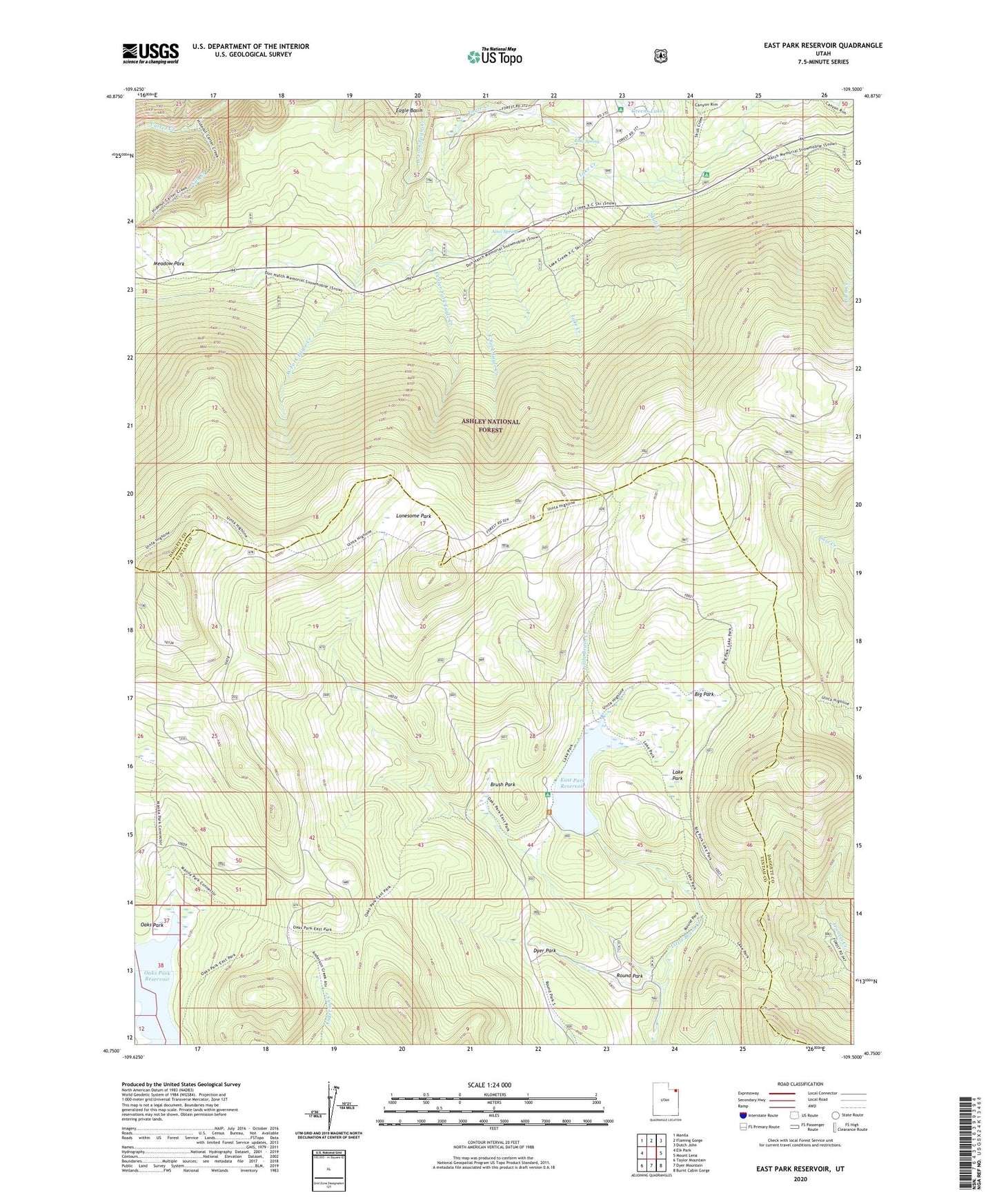
East Park Reservoir Utah US Topo Map
Couldn't load pickup availability
Also explore the East Park Reservoir Forest Service Topo of this same quad for updated USFS data
2023 topographic map quadrangle East Park Reservoir in the state of Utah. Scale: 1:24000. Based on the newly updated USGS 7.5' US Topo map series, this map is in the following counties: Uintah, Daggett. The map contains contour data, water features, and other items you are used to seeing on USGS maps, but also has updated roads and other features. This is the next generation of topographic maps. Printed on high-quality waterproof paper with UV fade-resistant inks.
Quads adjacent to this one:
West: Elk Park
Northwest: Manila
North: Flaming Gorge
Northeast: Dutch John
East: Mount Lena
Southeast: Burnt Cabin Gorge
South: Dyer Mountain
Southwest: Taylor Mountain
This map covers the same area as the classic USGS quad with code o40109g5.
Contains the following named places: Aztec Spring, Big Park, Brush Park, Center Fork Eagle Creek, Cub Creek, Dyer Park, East Fork Eagle Creek, East Park Campground, East Park Dam, East Park Reservoir, Greens Lakes Campground, Lake Creek, Lake Park, Lonesome Park, Meadow Park, Oaks Park Reservoir, Ross Spring, Round Park, Skull Creek Campground