MyTopo
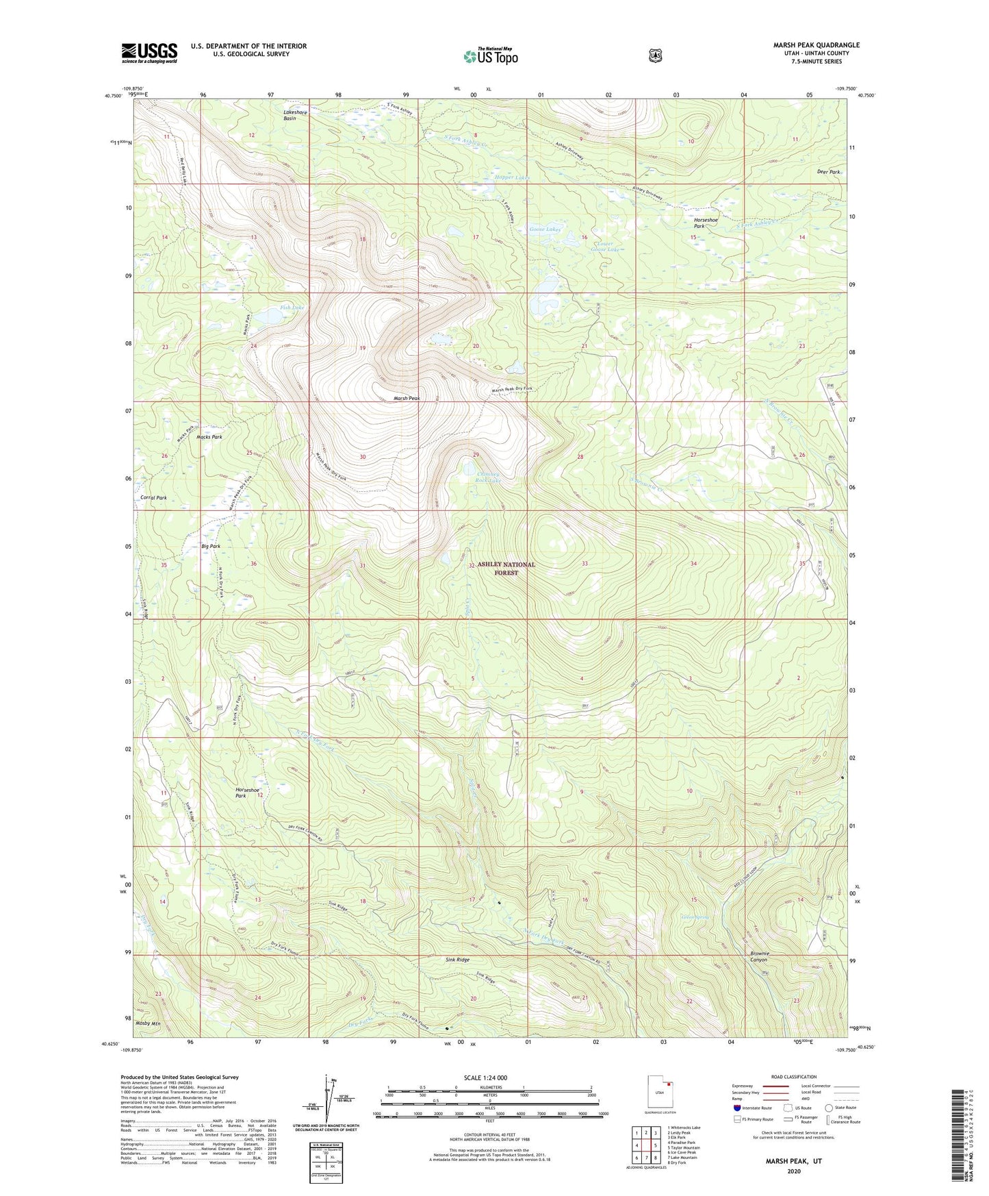
Marsh Peak Utah US Topo Map
Couldn't load pickup availability
Also explore the Marsh Peak Forest Service Topo of this same quad for updated USFS data
2023 topographic map quadrangle Marsh Peak in the state of Utah. Scale: 1:24000. Based on the newly updated USGS 7.5' US Topo map series, this map is in the following counties: Uintah. The map contains contour data, water features, and other items you are used to seeing on USGS maps, but also has updated roads and other features. This is the next generation of topographic maps. Printed on high-quality waterproof paper with UV fade-resistant inks.
Quads adjacent to this one:
West: Paradise Park
Northwest: Whiterocks Lake
North: Leidy Peak
Northeast: Elk Park
East: Taylor Mountain
Southeast: Dry Fork
South: Lake Mountain
Southwest: Ice Cave Peak
This map covers the same area as the classic USGS quad with code o40109f7.
Contains the following named places: Ashley Twin Lakes, Ashley Twin Lakes Dam, Big Park, Chimney Rock Lake, Corral Park, Fish Lake, Goose Lakes, Green Spring, Hopper Lakes, Horseshoe Park, Lower Goose Lake, Lower Goose Lake Dam, Macks Park, Marsh Peak, Sink Ridge, Split Creek, Upper Goose Lake, Upper Goose Lake Dam