MyTopo
Cow Flats Utah US Topo Map
Couldn't load pickup availability
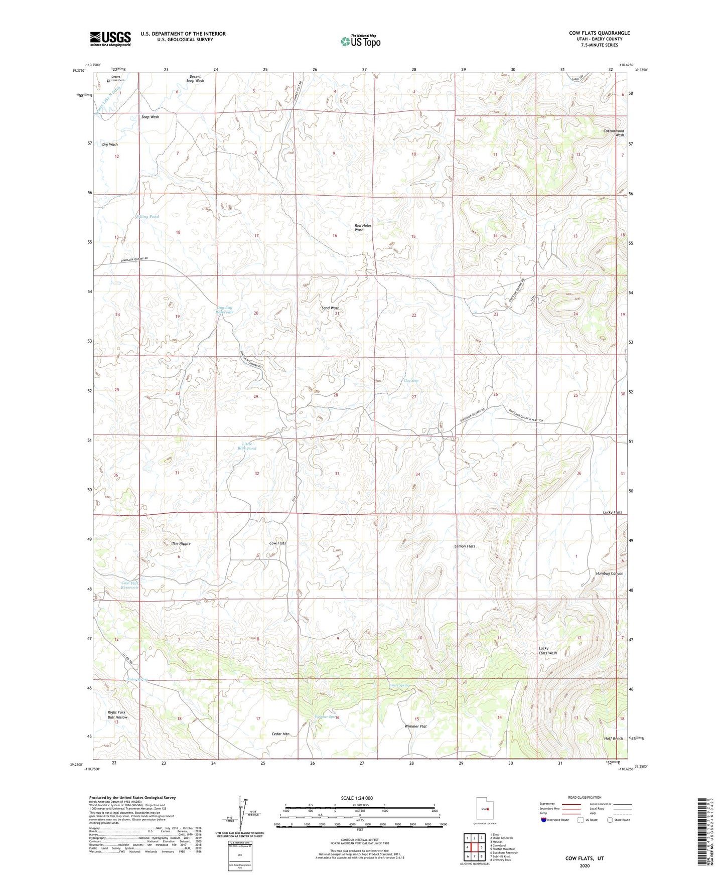
2023 topographic map quadrangle Cow Flats in the state of Utah. Scale: 1:24000. Based on the newly updated USGS 7.5' US Topo map series, this map is in the following counties: Emery. The map contains contour data, water features, and other items you are used to seeing on USGS maps, but also has updated roads and other features. This is the next generation of topographic maps. Printed on high-quality waterproof paper with UV fade-resistant inks.
Quads adjacent to this one:
West: Cleveland
Northwest: Elmo
North: Olsen Reservoir
Northeast: Mounds
East: Flattop Mountain
Southeast: Chimney Rock
South: Bob Hill Knoll
Southwest: Buckhorn Reservoir
This map covers the same area as the classic USGS quad with code o39110c6.
Contains the following named places: Clay Seep, Cleveland Lloyd Dinosaur Quarry, Cleveland-Lloyd Dinosaur Quarry Campground, Cow Flat Reservoir, Cow Flats, Desert Lake Cemetery, Desert Lake North Ditch, Dry Wash, Dugway Reservoir, Lemon Flats, Little Blue Pond, Pilling Pond, Right Fork Bull Hollow, Soap Wash, Staker Spring, The Nipple, Ware Spring, Wimmer Spring