MyTopo
Wellington Utah US Topo Map
Couldn't load pickup availability
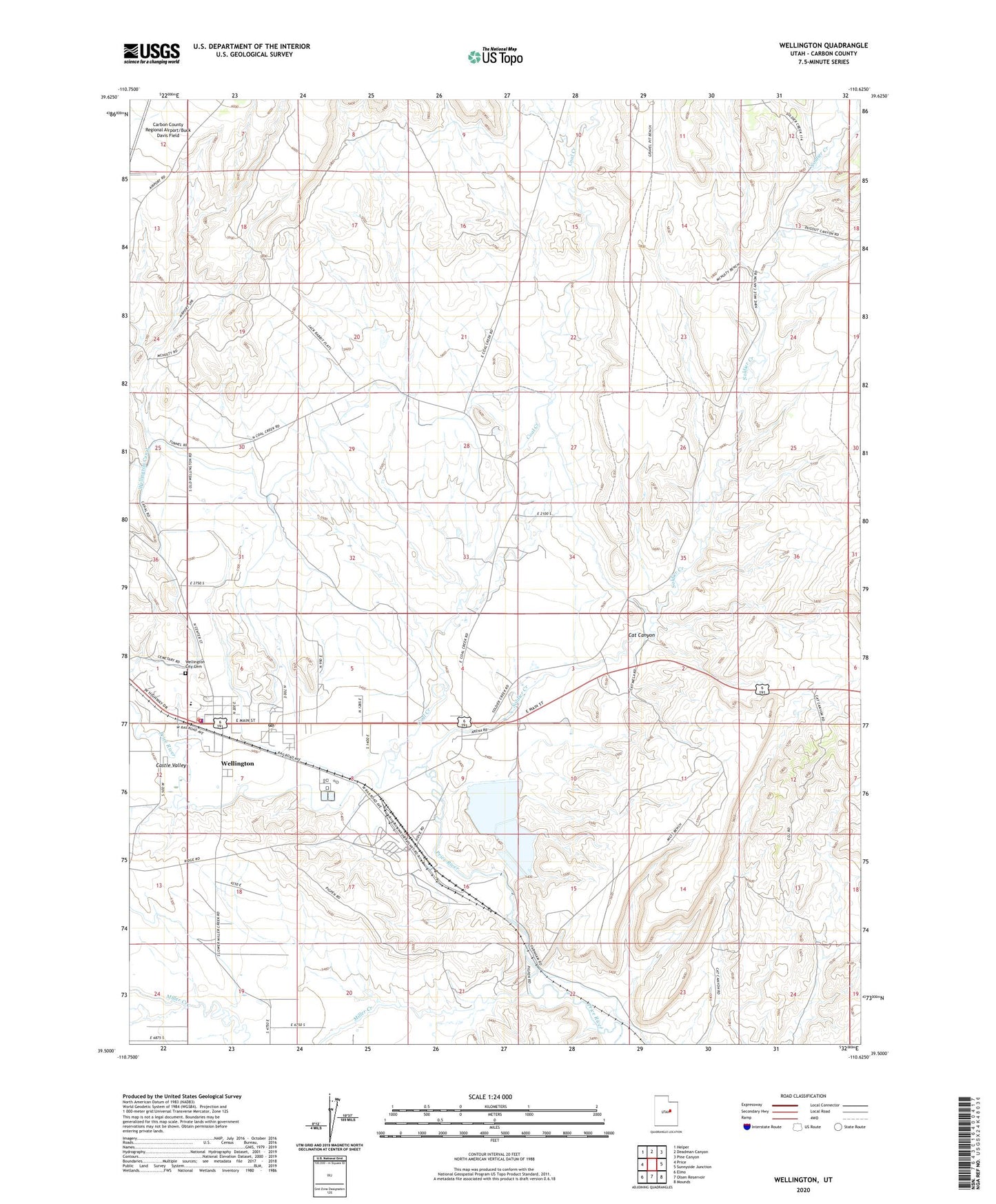
2023 topographic map quadrangle Wellington in the state of Utah. Scale: 1:24000. Based on the newly updated USGS 7.5' US Topo map series, this map is in the following counties: Carbon. The map contains contour data, water features, and other items you are used to seeing on USGS maps, but also has updated roads and other features. This is the next generation of topographic maps. Printed on high-quality waterproof paper with UV fade-resistant inks.
Quads adjacent to this one:
West: Price
Northwest: Helper
North: Deadman Canyon
Northeast: Pine Canyon
East: Sunnyside Junction
Southeast: Mounds
South: Olsen Reservoir
Southwest: Elmo
This map covers the same area as the classic USGS quad with code o39110e6.
Contains the following named places: Castle Valley, Cat Canyon, City of Wellington, Coal Creek, First Baptist Church, Hillview RV Park Campground, Miller Creek, Soldier Creek, The Church of Jesus Christ of Latter Day Saints, U S Steel Corp Storage Dam, U S Steel Corp Storage Reservoir, Wellington, Wellington Canal, Wellington City Cemetery, Wellington Elementary School, Wellington Police Department, Wellington Post Office, Wellington Volunteer Fire Department, ZIP Code: 84542