MyTopo
Fairview Lakes Utah US Topo Map
Couldn't load pickup availability
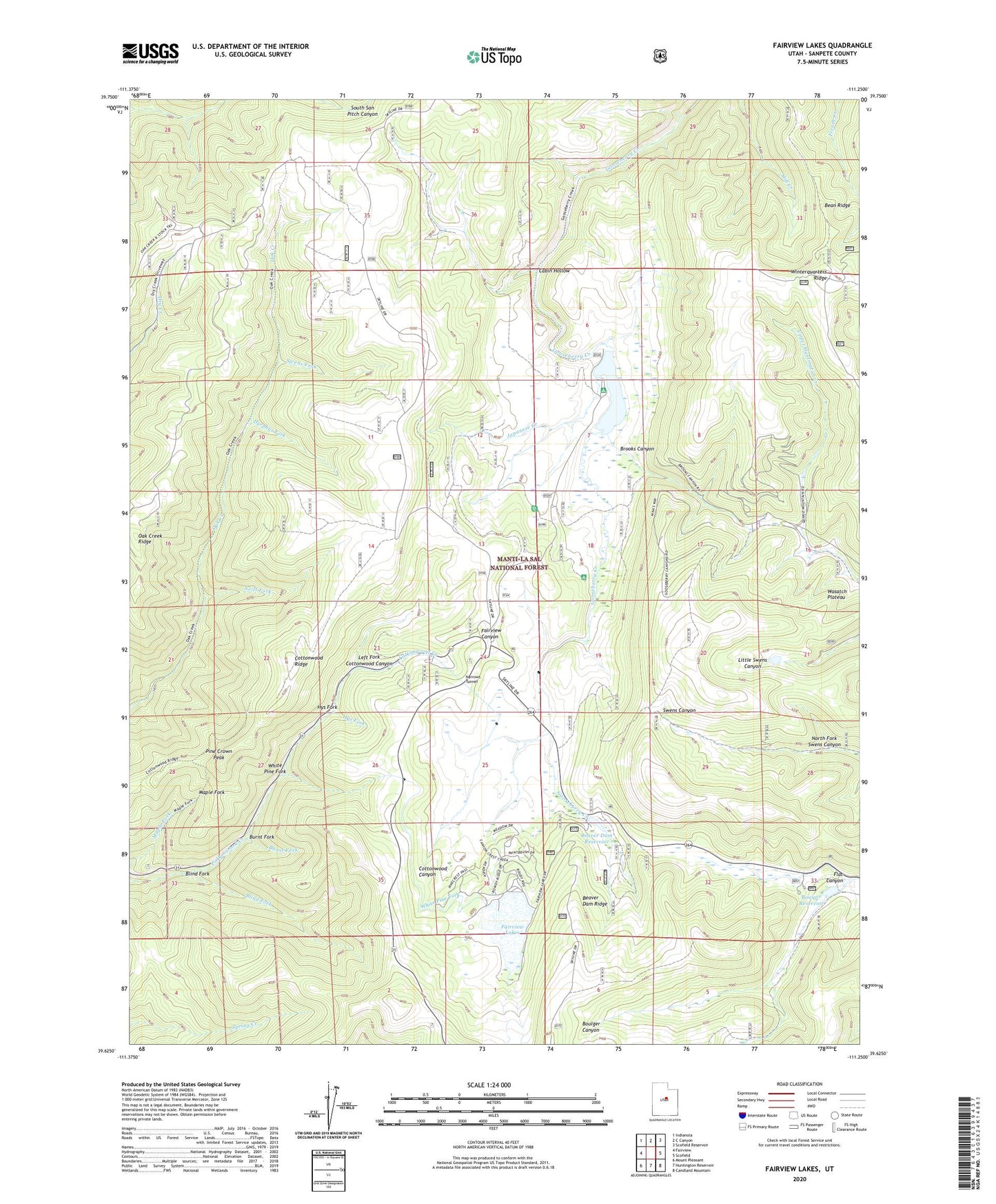
2020 topographic map quadrangle Fairview Lakes in the state of Utah. Scale: 1:24000. Based on the newly updated USGS 7.5' US Topo map series, this map is in the following counties: Sanpete. The map contains contour data, water features, and other items you are used to seeing on USGS maps, but also has updated roads and other features. This is the next generation of topographic maps. Printed on high-quality waterproof paper with UV fade-resistant inks.
Quads adjacent to this one:
West: Fairview
Northwest: Indianola
North: C Canyon
Northeast: Scofield Reservoir
East: Scofield
Southeast: Candland Mountain
South: Huntington Reservoir
Southwest: Mount Pleasant
Contains the following named places: Bean Ridge, Beaver Dam, Beaver Dam Reservoir, Beaver Dam Ridge, Beaver Dams Summer Homes Area, Blind Fork, Boulger Reservoir, Brooks Canyon, Burnt Fork, Cabin Hollow, Cottonwood Ridge, Durphys Fork, Fairview Lakes, Fairview Lakes Dam, Fairview Lakes Overlook, Flat Canyon, Flat Canyon Campground, Gooseberry Campground, Hys Fork, Japanese Creek, Left Fork Cottonwood Canyon, Lower Gooseberry Reservoir, Lower Gooseberry Reservoir Dam, Mammoth Ranger Station, Narrows Tunnel, Neils Fork, North Fork Swens Canyon, Oak Creek Ridge, Pine Crown Peak, Snowland Ski Area, Swens Fork, White Pine Fork, Winterquarters Ridge