MyTopo
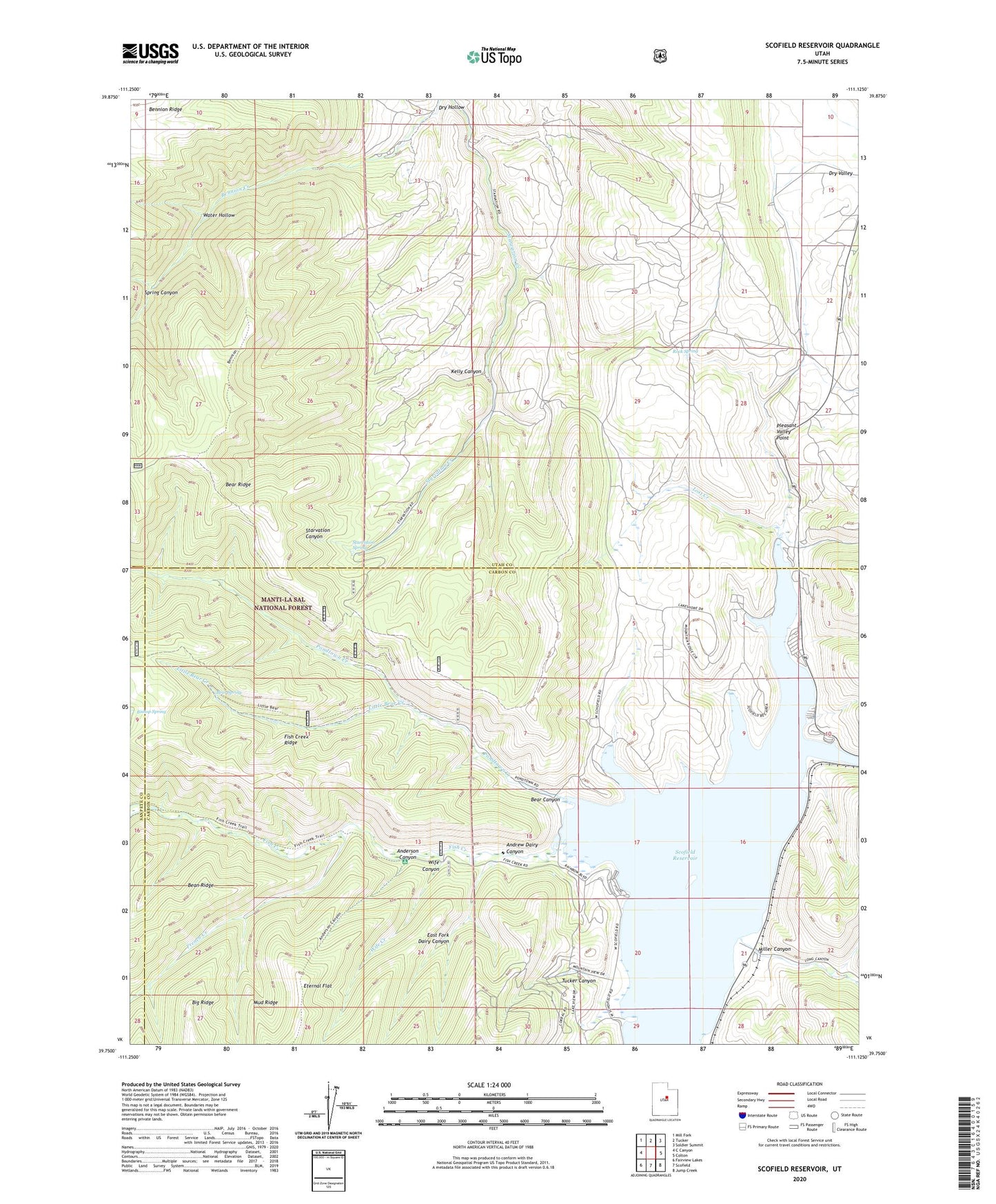
Scofield Reservoir Utah US Topo Map
Couldn't load pickup availability
Also explore the Scofield Reservoir Forest Service Topo of this same quad for updated USFS data
2023 topographic map quadrangle Scofield Reservoir in the state of Utah. Scale: 1:24000. Based on the newly updated USGS 7.5' US Topo map series, this map is in the following counties: Utah, Carbon, Sanpete. The map contains contour data, water features, and other items you are used to seeing on USGS maps, but also has updated roads and other features. This is the next generation of topographic maps. Printed on high-quality waterproof paper with UV fade-resistant inks.
Quads adjacent to this one:
West: C Canyon
Northwest: Mill Fork
North: Tucker
Northeast: Soldier Summit
East: Colton
Southeast: Jump Creek
South: Scofield
Southwest: Fairview Lakes
This map covers the same area as the classic USGS quad with code o39111g2.
Contains the following named places: Anderson Canyon, Anderson Creek, Andrew Dairy Canyon, Bear Canyon, Bear Spring, Bishop Spring, Dry Hollow, East Fork Andrew Dairy Canyon, Eternal Flat, Fish Creek, Fish Creek Campground, French Creek, Gooseberry Creek, Kelly Canyon, Little Bear Creek, Lost Creek, Miller Canyon, Mud Ridge, Pleasant Valley Point, Pondtown Creek, Pondtown Mine, Rock Spring, Scofield Campground, Scofield Lake SRA Recreation Site, Scofield Reservoir, Scofield State Park, Spring Canyon, Starvation Spring, The Backswitch, Tucker Canyon, Water Hollow, Wife Canyon, Wife Creek