MyTopo
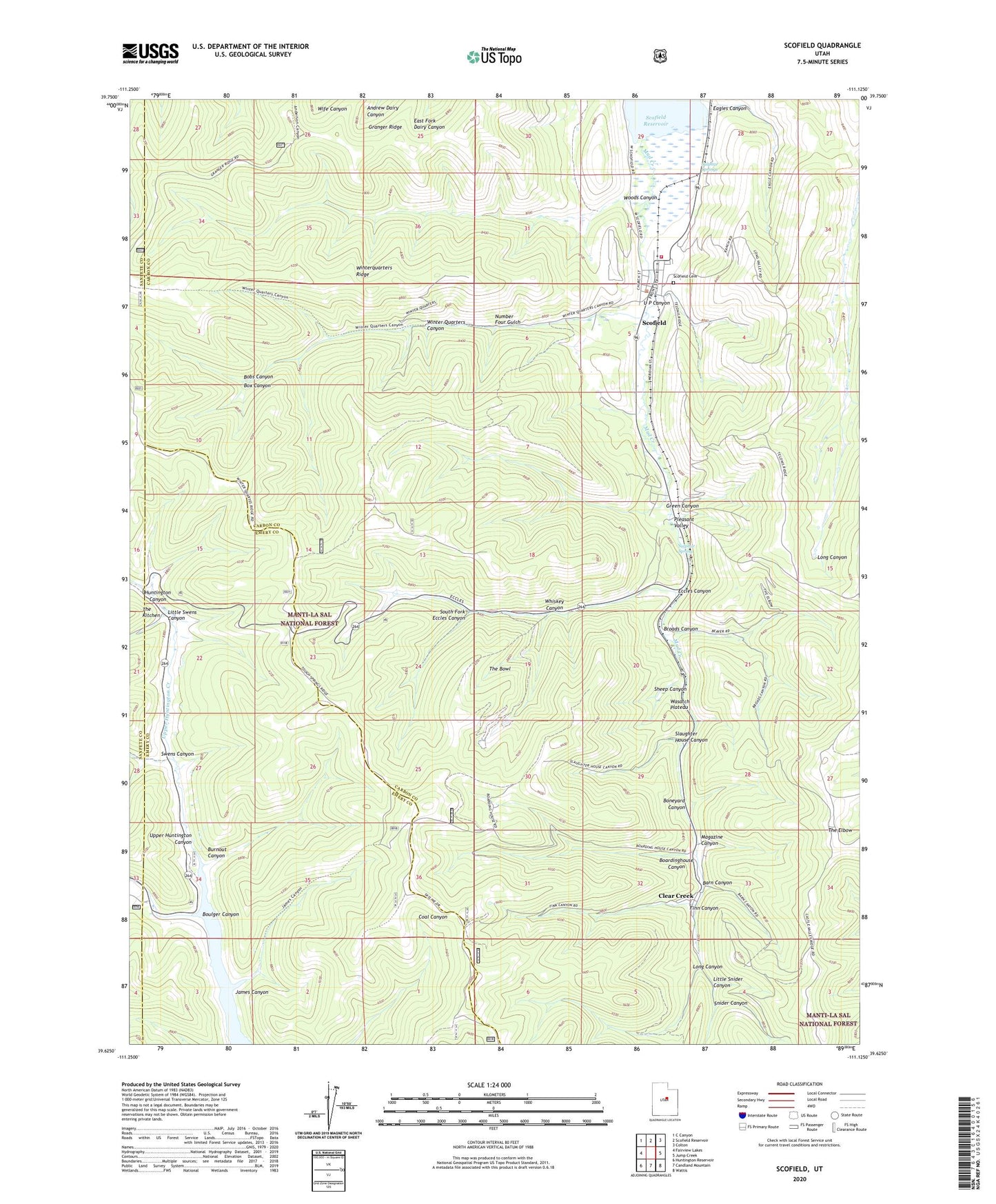
Scofield Utah US Topo Map
Couldn't load pickup availability
Also explore the Scofield Forest Service Topo of this same quad for updated USFS data
2023 topographic map quadrangle Scofield in the state of Utah. Scale: 1:24000. Based on the newly updated USGS 7.5' US Topo map series, this map is in the following counties: Carbon, Emery, Sanpete. The map contains contour data, water features, and other items you are used to seeing on USGS maps, but also has updated roads and other features. This is the next generation of topographic maps. Printed on high-quality waterproof paper with UV fade-resistant inks.
Quads adjacent to this one:
West: Fairview Lakes
Northwest: C Canyon
North: Scofield Reservoir
Northeast: Colton
East: Jump Creek
Southeast: Wattis
South: Candland Mountain
Southwest: Huntington Reservoir
This map covers the same area as the classic USGS quad with code o39111f2.
Contains the following named places: Barn Canyon, Belina Mine, Big Ridge, Boardinghouse Canyon, Bobs Canyon, Boneyard Canyon, Boulger Canyon, Box Canyon, Broads Canyon, Burnout Canyon, Clear Creek, Clear Creek Census Designated Place, Clear Creek Mines Number 3, Clear Creek Mines Number 4, Eagles Canyon, Eccles Canyon, Finn Canyon, Gibson Mine, Granger Ridge, Green Canyon, James Canyon, Little Snider Canyon, Little Swens Canyon, Long Canyon, Magazine Canyon, Mud Creek, Number Four Gulch, O'Conner Mine, Old Black Diamond Mine, Pleasant Valley, Scofield, Scofield Cemetery, Scofield Fire Station, Sheep Canyon, Skyline Mine, Slaughter House Canyon, Snider Canyon, South Fork Eccles Canyon, Sulphur Spring, Sulphur Springs, Swens Canyon, The Bowl, The Church of Jesus Christ of Latter Day Saints, The Kitchen, Town of Scofield, U P Canyon, Upper Huntington Canyon, Upper Huntington Creek, Utah Mine, Whiskey Canyon, Winter Quarters, Winter Quarters Canyon, Woods Canyon