MyTopo
Ferron Reservoir Utah US Topo Map
Couldn't load pickup availability
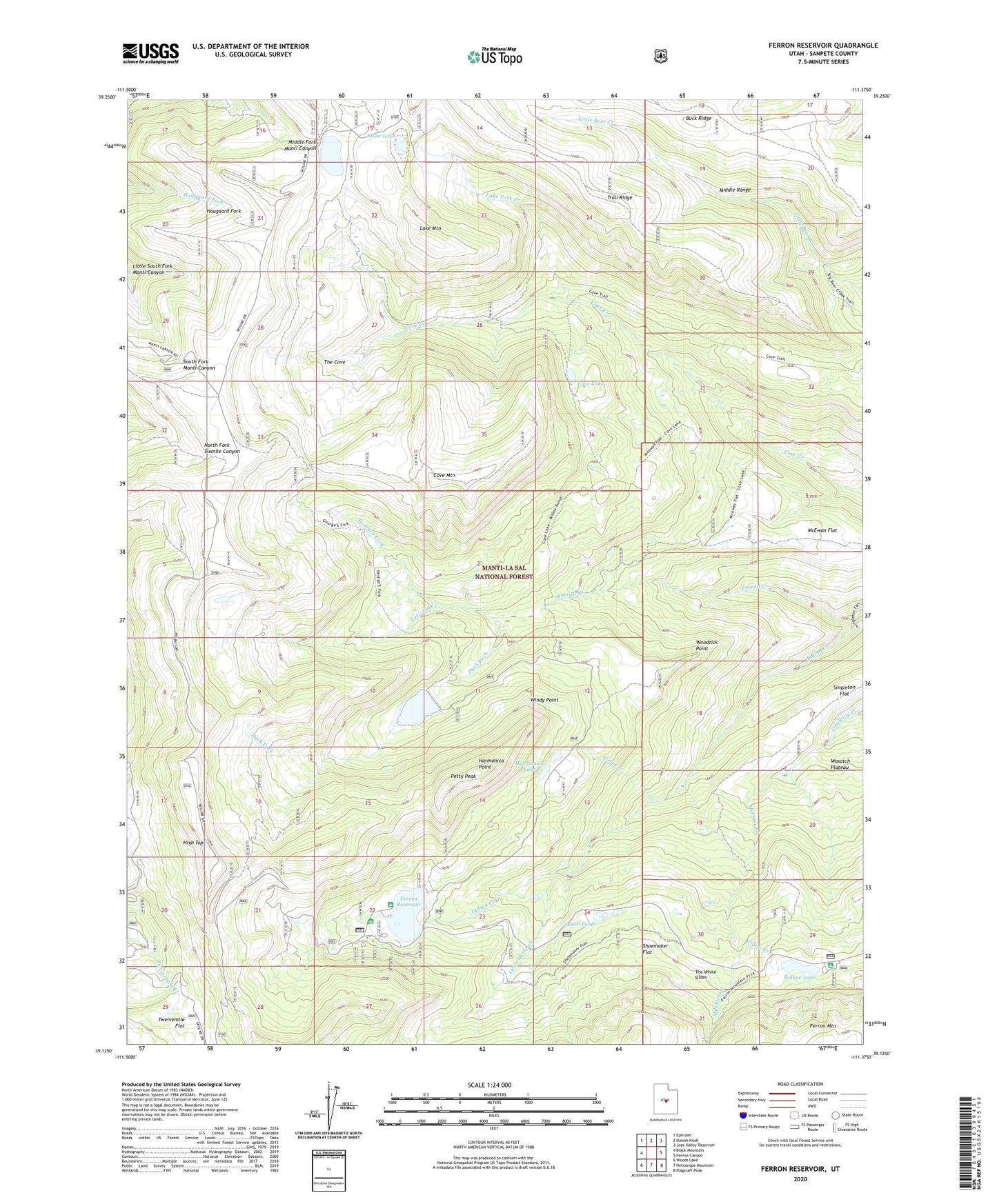
2020 topographic map quadrangle Ferron Reservoir in the state of Utah. Scale: 1:24000. Based on the newly updated USGS 7.5' US Topo map series, this map is in the following counties: Sanpete. The map contains contour data, water features, and other items you are used to seeing on USGS maps, but also has updated roads and other features. This is the next generation of topographic maps. Printed on high-quality waterproof paper with UV fade-resistant inks.
Quads adjacent to this one:
West: Black Mountain
Northwest: Ephraim
North: Danish Knoll
Northeast: Joes Valley Reservoir
East: Ferron Canyon
Southeast: Flagstaff Peak
South: Heliotrope Mountain
Southwest: Woods Lake
Contains the following named places: Buck Ridge, Cold Creek, Cove Lake, Cove Mountain, Duck Fork, Duck Fork Dam, Duck Fork Reservoir, Ferron Campground, Ferron Dam, Ferron Reservoir, Ferron Reservoir Campground, Ferron Reservoir Summer Home Area, Georges Fork, Harmonica Lake, Harmonica Point, High Top, Indian Creek, Indian Creek Administrative Site, Jet Fox Reservoir, Lake Fork, Lake Fork Creek, Lake Mountain, Little Horse Creek, Little South Fork Manti Canyon, Mill Stream, Petty Peak, Rush Pond, Shoemaker Flat, Singleton Flat, Snow Lake, The Cove, The White Slides, Twelvemile Flat, Willow Bunch, Willow Creek, Willow Lake, Willow Lake Campground, Willow Lake Dam, Windy Point, Woodtick Point