MyTopo
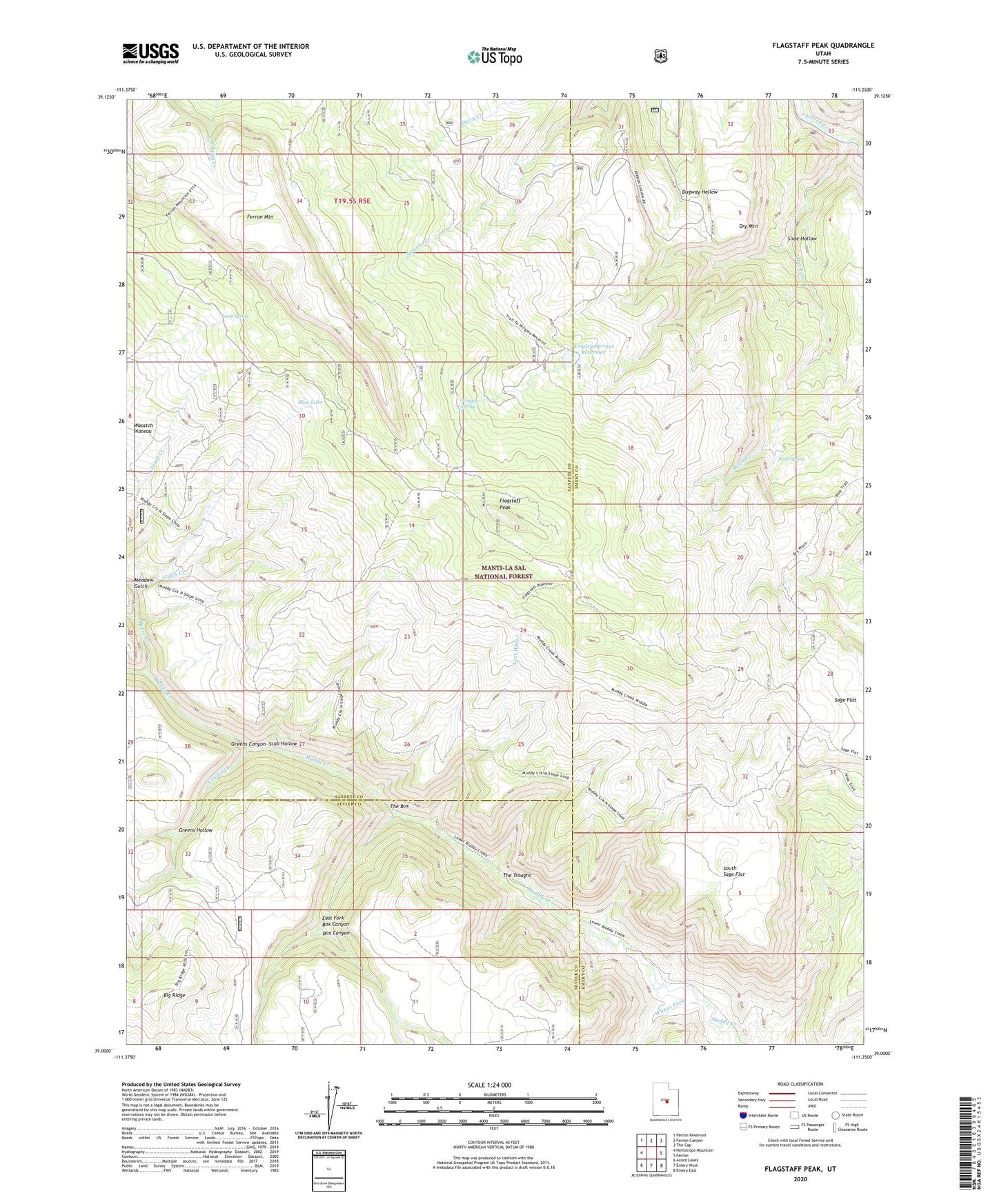
Flagstaff Peak Utah US Topo Map
Couldn't load pickup availability
Also explore the Flagstaff Peak Forest Service Topo of this same quad for updated USFS data
2023 topographic map quadrangle Flagstaff Peak in the state of Utah. Scale: 1:24000. Based on the newly updated USGS 7.5' US Topo map series, this map is in the following counties: Sanpete, Emery, Sevier. The map contains contour data, water features, and other items you are used to seeing on USGS maps, but also has updated roads and other features. This is the next generation of topographic maps. Printed on high-quality waterproof paper with UV fade-resistant inks.
Quads adjacent to this one:
West: Heliotrope Mountain
Northwest: Ferron Reservoir
North: Ferron Canyon
Northeast: The Cap
East: Ferron
Southeast: Emery East
South: Emery West
Southwest: Acord Lakes
This map covers the same area as the classic USGS quad with code o39111a3.
Contains the following named places: Birch Creek, Birch Spring, Blue Lake, Box Canyon, Cowboy Creek, Dry Mountain, East Fork Box Canyon, Ferron Canyon Campground, Ferron Canyon Overlook, Flagstaff Peak, Greens Canyon, Greens Hollow, Gulch Creek, Horse Creek, Jason Cabin, Jason Spring, Last Water, Meadow Gulch, Sage Flat, Scab Hollow, Slide Hollow, South Sage Flat, Stevens Forest Service Facility, Steves Creek Administrative Site, The Box, The Troughs, Wileys Fork, Wrigley Spring, Wrigley Springs Dam, Wrigley Springs Reservoir