MyTopo
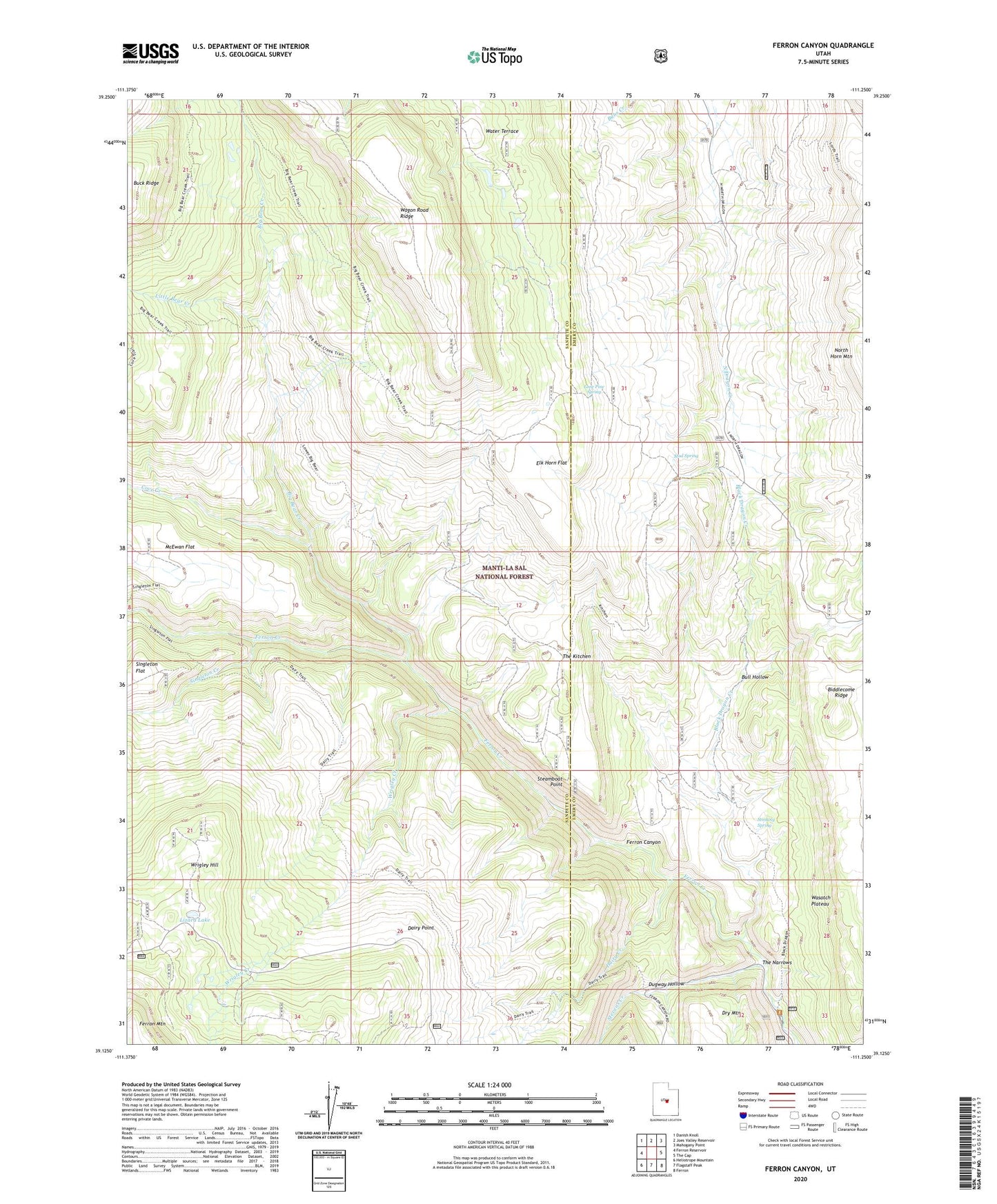
Ferron Canyon Utah US Topo Map
Couldn't load pickup availability
Also explore the Ferron Canyon Forest Service Topo of this same quad for updated USFS data
2023 topographic map quadrangle Ferron Canyon in the state of Utah. Scale: 1:24000. Based on the newly updated USGS 7.5' US Topo map series, this map is in the following counties: Sanpete, Emery. The map contains contour data, water features, and other items you are used to seeing on USGS maps, but also has updated roads and other features. This is the next generation of topographic maps. Printed on high-quality waterproof paper with UV fade-resistant inks.
Quads adjacent to this one:
West: Ferron Reservoir
Northwest: Danish Knoll
North: Joes Valley Reservoir
Northeast: Mahogany Point
East: The Cap
Southeast: Ferron
South: Flagstaff Peak
Southwest: Heliotrope Mountain
This map covers the same area as the classic USGS quad with code o39111b3.
Contains the following named places: Biddlecome Ridge, Big Bear Creek, Black Dragon Creek, Bull Hollow, Cove Creek, Dairy Creek, Dairy Point, Dairy Trail, Dugway Hollow, Elk Horn Flat, Ferron Canyon, Horn Mountain Cow Camp, Little Bear Creek, Lizard Lake, Lone Pine Spring, Lone Tree, Manti-La Sal National Forest, McEwan Flat, Mud Spring, Singleton Creek, Steamboat Point, Stevens Creek, Stinking Spring, The Kitchen, The Narrows, Water Terrace, Wrigley Creek, Wrigley Hill