MyTopo
Woods Lake Utah US Topo Map
Couldn't load pickup availability
Also explore the Woods Lake Forest Service Topo of this same quad for updated USFS data
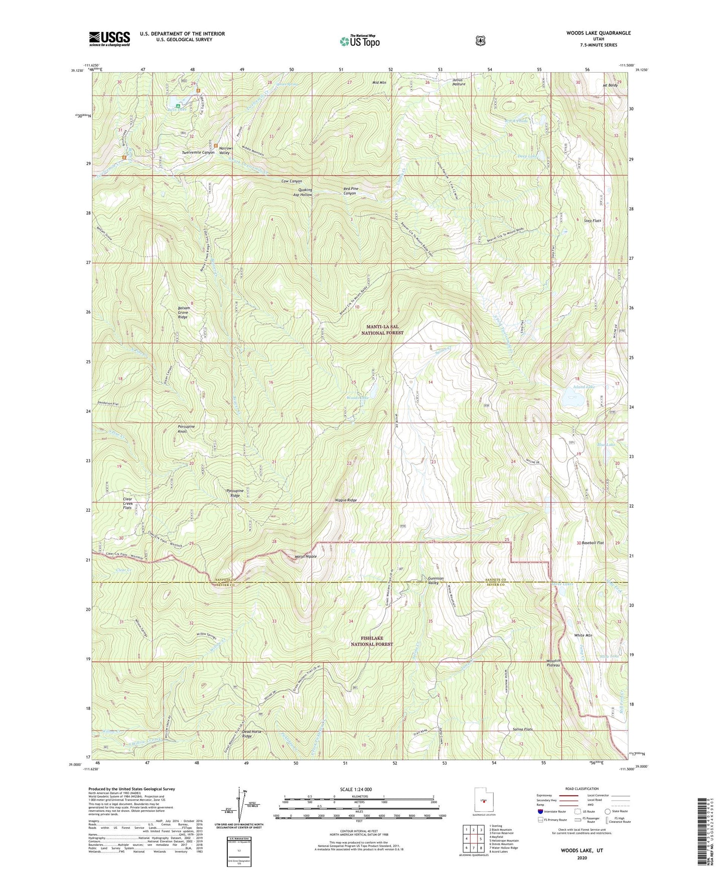
2023 topographic map quadrangle Woods Lake in the state of Utah. Scale: 1:24000. Based on the newly updated USGS 7.5' US Topo map series, this map is in the following counties: Sanpete, Sevier. The map contains contour data, water features, and other items you are used to seeing on USGS maps, but also has updated roads and other features. This is the next generation of topographic maps. Printed on high-quality waterproof paper with UV fade-resistant inks.
Quads adjacent to this one:
West: Mayfield
Northwest: Sterling
North: Black Mountain
Northeast: Ferron Reservoir
East: Heliotrope Mountain
Southeast: Acord Lakes
South: Water Hollow Ridge
Southwest: Steves Mountain
This map covers the same area as the classic USGS quad with code o39111a5.
Contains the following named places: Balsam Grove Ridge, Baseball Flat, Beaver Creek, Birch Creek, Blue Lake, Clear Creek Flats, Cooley Creek, Cow Canyon, Cowboy Camp, Dead Horse Ridge, Deep Lake, Deep Lake Dam, Gunnison Valley, Island Lake, Jump Creek, Marys Nipple, Mill Fork Creek, Musinea Administrative Site, Narrows Valley, Nipple Ridge, Pinchot Campground, Porcupine Knoll, Porcupine Ridge, Quaking Asp Hollow, Red Pine Canyon, Slide Lake, South Fork Twelvemile Creek, South Fork Willow Creek, Spruce Spring, Step Flats, Three Lakes, Twin Lake, Twin Lake Dam, W P A Ponds, Whitlock Cabin, Woods Lake