MyTopo
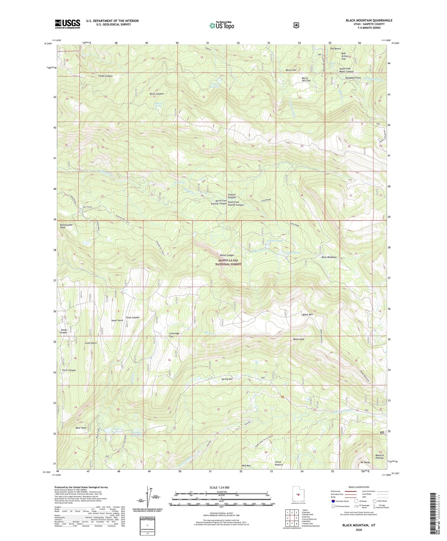
Black Mountain Utah US Topo Map
Couldn't load pickup availability
Also explore the Black Mountain Forest Service Topo of this same quad for updated USFS data
2023 topographic map quadrangle Black Mountain in the state of Utah. Scale: 1:24000. Based on the newly updated USGS 7.5' US Topo map series, this map is in the following counties: Sanpete. The map contains contour data, water features, and other items you are used to seeing on USGS maps, but also has updated roads and other features. This is the next generation of topographic maps. Printed on high-quality waterproof paper with UV fade-resistant inks.
Quads adjacent to this one:
West: Sterling
Northwest: Manti
North: Ephraim
Northeast: Danish Knoll
East: Ferron Reservoir
Southeast: Heliotrope Mountain
South: Woods Lake
Southwest: Mayfield
This map covers the same area as the classic USGS quad with code o39111b5.
Contains the following named places: Bear Hole, Black Hole, Black Mountain, Blue Meadows, Bub Arthurs Flat, Burnt Hill, Burnt Hill Flat, Dry Hole Reservoir, Ephraim-Manti Division, Grove of the Aspen Giants Scenic Area, Harmon Trail, Hougaard Fork, Julius Pasture, Leo Spring, Loveridge Flat, Lower Pond, Lower Ranch, Metcalf Spring, Middle Mountain, Milk Creek, Milky Falls, Mount Baldy, Mount Baldy Guard Station, Newfield Reservoir, North Fork Sixmile Canyon, Patton Reservoir, Peacock Wildlife Management Area, Sixmile Ponds, South Fork Sixmile Canyon, Spring Hill, Town Reservoir, Town Reservoir Dam, Upper Pond, Upper Ranch, White Ledges, Wildwest