MyTopo
Fish Lake Utah US Topo Map
Couldn't load pickup availability
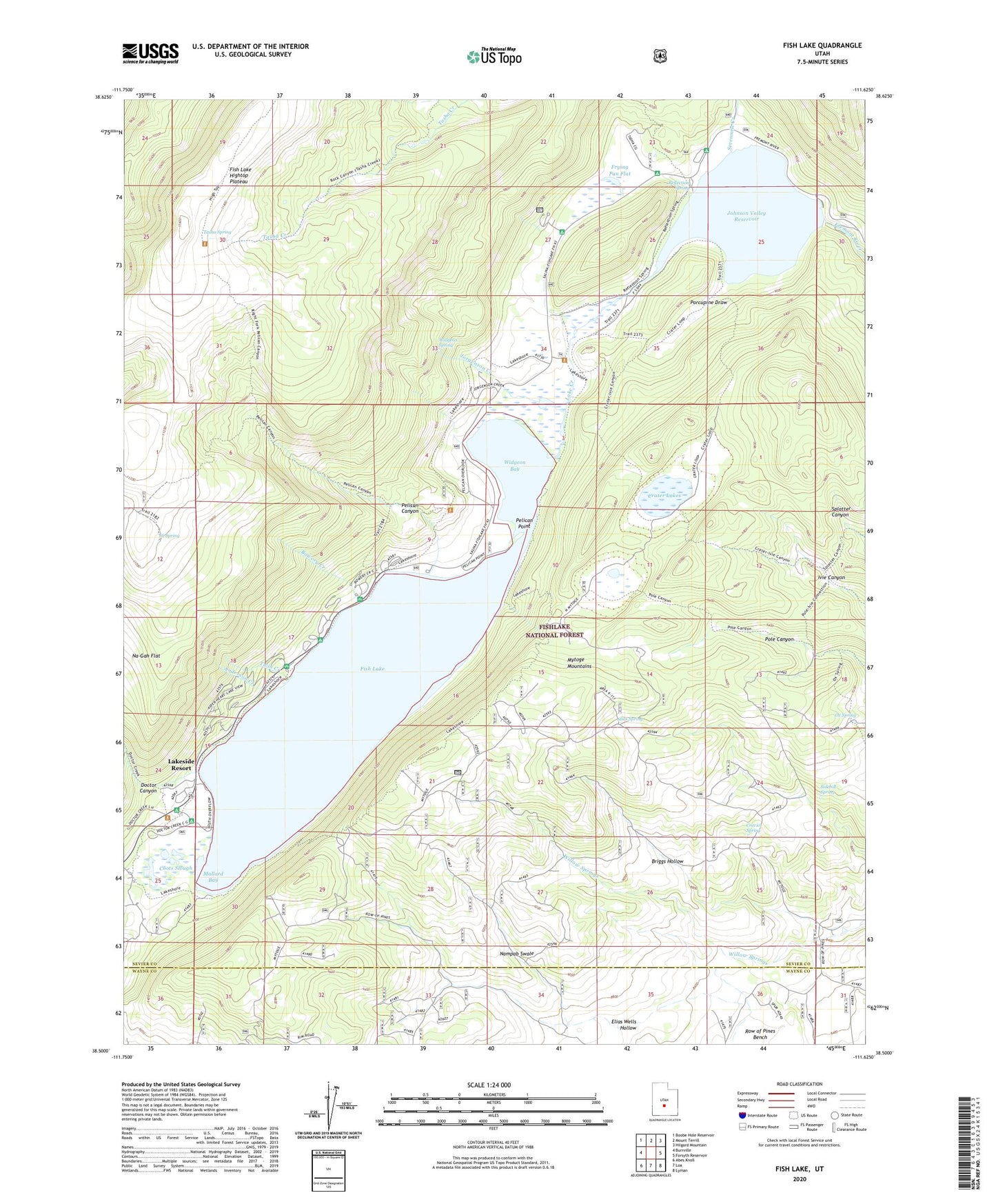
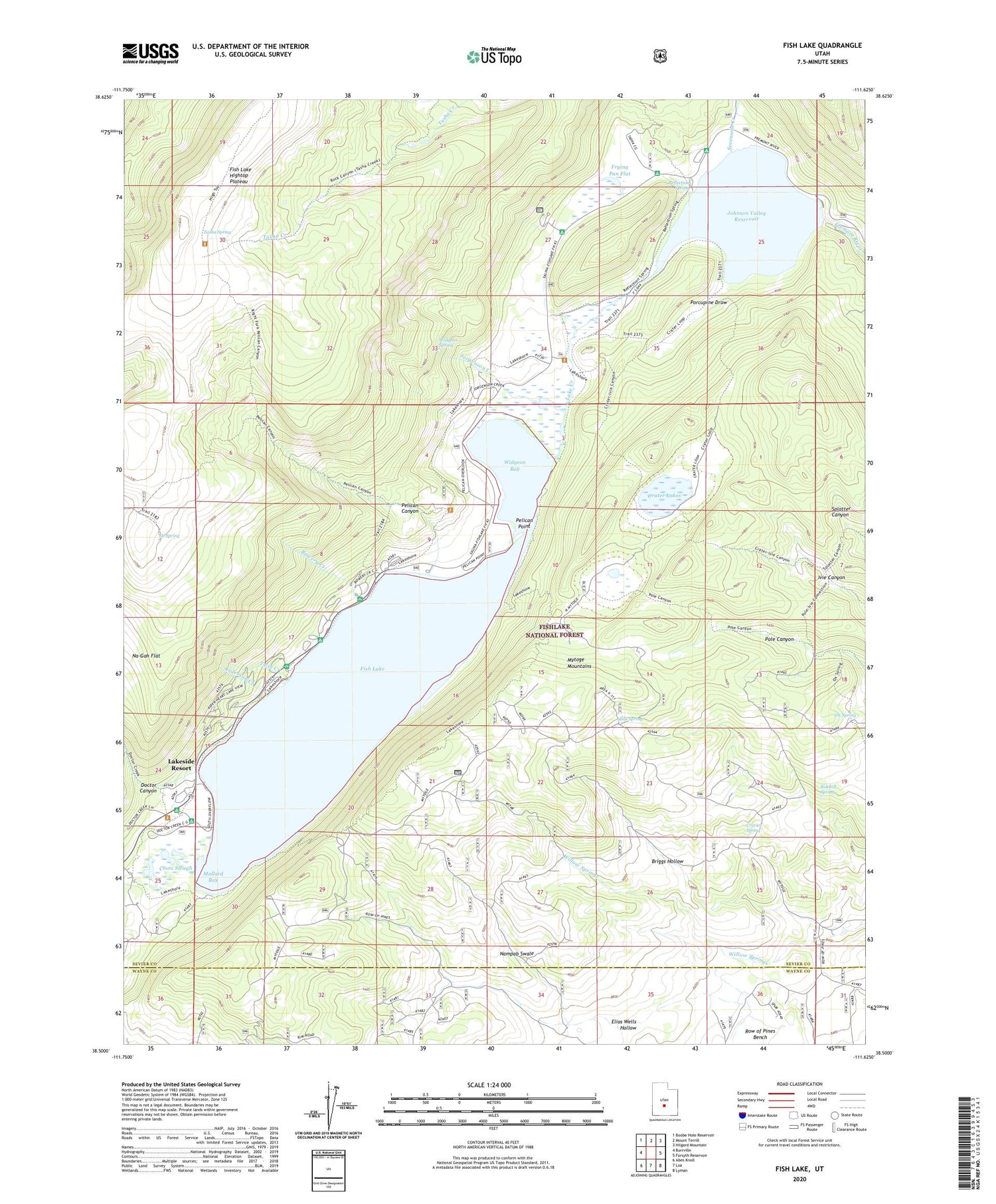
2020 topographic map quadrangle Fish Lake in the state of Utah. Scale: 1:24000. Based on the newly updated USGS 7.5' US Topo map series, this map is in the following counties: Sevier, Wayne. The map contains contour data, water features, and other items you are used to seeing on USGS maps, but also has updated roads and other features. This is the next generation of topographic maps. Printed on high-quality waterproof paper with UV fade-resistant inks.
Quads adjacent to this one:
West: Burrville
Northwest: Boobe Hole Reservoir
North: Mount Terrill
Northeast: Hilgard Mountain
East: Forsyth Reservoir
Southeast: Lyman
South: Loa
Southwest: Abes Knoll
Contains the following named places: Anderson Creek, Aspen Heart and Lakeview Recreation Residences, Bowery Creek, Bowery Creek Campground, Bowery Group Area Recreation Site, Bowery Haven Resort, Briggs Hollow, Coots Slough, Crater Lakes, Crevice Spring, Doctor Canyon, Doctor Creek Campground, Doctor Creek Group Area, Doctor Creek Recreation Residences, Elias Wells Hollow, Fish Lake, Fish Lake Hightop Plateau, Fish Lake Lodge, Fish Lake Ranger Station, Fish Lake Visitor Center, Fishlake Resort, Frying Pan Campground, Frying Pan Flat, Hi Spring, Joe Bush Fisherman Parking, Johnson Reservoir Campground, Johnson Valley Dam, Johnson Valley Reservoir, Jorgenson Creek, Lake Creek, Lakeside Resort, Mackinaw Campground, Mallard Bay, Mytoge Mountains, Nampab Swale, Ox Spring, Pelican Canyon, Pelican Overlook, Pelican Point, Pelican Point Campground, Piute Campground, Porcupine Draw, Reflection Spring, Sevenmile Creek, Sidehill Spring, Silas Spring, Tasha Recreation Site, Tasha Spring, Twin Creek, Twin Creek Amphitheater Recreation Site, Twin Creek Picnic Area, Widgeon Bay, Widgeon Spring, Willow Springs, ZIP Code: 84701