
MyTopo
Fivemile Ridge Utah US Topo Map
Couldn't load pickup availability
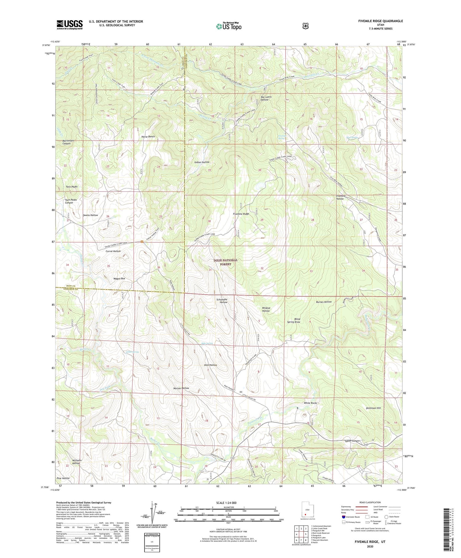
2020 topographic map quadrangle Fivemile Ridge in the state of Utah. Scale: 1:24000. Based on the newly updated USGS 7.5' US Topo map series, this map is in the following counties: Garfield, Iron. The map contains contour data, water features, and other items you are used to seeing on USGS maps, but also has updated roads and other features. This is the next generation of topographic maps. Printed on high-quality waterproof paper with UV fade-resistant inks.
Quads adjacent to this one:
West: Red Creek Reservoir
Northwest: Cottonwood Mountain
North: Little Creek Peak
Northeast: Panguitch NW
East: Panguitch
Southeast: Hatch
South: Haycock Mountain
Southwest: Panguitch Lake
Contains the following named places: Billy Spring, Blind Spring Draw, Burnes Hollow, Butler Creek, Caddy Creek, Corral Hollow, Delong Creek, Dickinson Hill, Doc Lewis Hollow, Dry Fork, Fivemile Ridge, Fivemile Spring, Horse Bench, Indian Hollow, Mud Spring, North Fork Threemile Creek, Norton Hollow, Owens Hollow, Pole Hollow, Schumake Hollow, South Fork Threemile Creek, Tebbs Spring, Twin Peaks Canyon, Wagon Box, White Rocks, Wildcat Hollow


