MyTopo
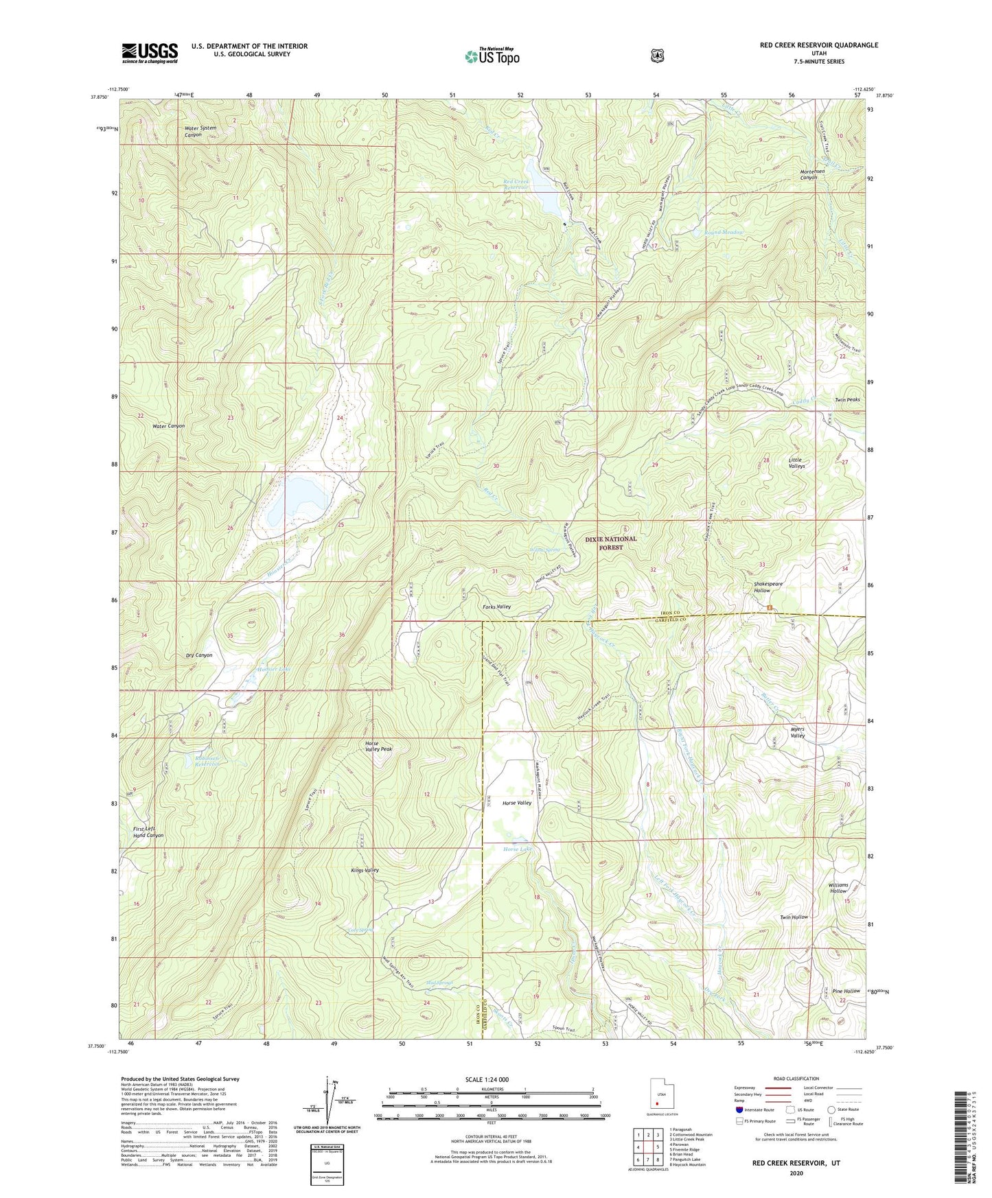
Red Creek Reservoir Utah US Topo Map
Couldn't load pickup availability
Also explore the Red Creek Reservoir Forest Service Topo of this same quad for updated USFS data
2023 topographic map quadrangle Red Creek Reservoir in the state of Utah. Scale: 1:24000. Based on the newly updated USGS 7.5' US Topo map series, this map is in the following counties: Iron, Garfield. The map contains contour data, water features, and other items you are used to seeing on USGS maps, but also has updated roads and other features. This is the next generation of topographic maps. Printed on high-quality waterproof paper with UV fade-resistant inks.
Quads adjacent to this one:
West: Parowan
Northwest: Paragonah
North: Cottonwood Mountain
Northeast: Little Creek Peak
East: Fivemile Ridge
Southeast: Haycock Mountain
South: Panguitch Lake
Southwest: Brian Head
This map covers the same area as the classic USGS quad with code o37112g6.
Contains the following named places: Cove Spring, Dry Fork, Forks Valley, Foster Dam, Foster Reservoir, Hoosier Creek, Hoosier Lake, Horse Lake, Horse Valley, Horse Valley Peak, Kings Valley, Left Fork Haycock Creek, Little Valleys, Mud Springs, Myers Valley, Red Creek Dam, Red Creek Reservoir, Right Fork Haycock Creek, Robinson Reservoir, Round Meadow, Shakespeare Hollow, Spruce Trail, Trail Creek, Twin Peaks, Water System Canyon, Willow Spring