MyTopo
Panguitch Lake Utah US Topo Map
Couldn't load pickup availability
Also explore the Panguitch Lake Forest Service Topo of this same quad for updated USFS data
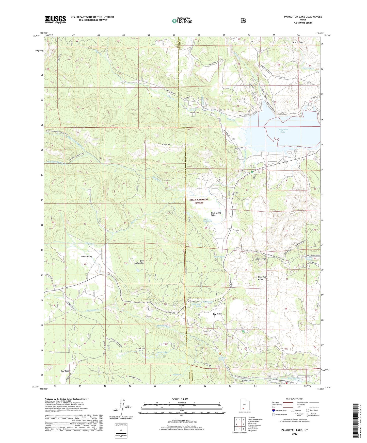
2023 topographic map quadrangle Panguitch Lake in the state of Utah. Scale: 1:24000. Based on the newly updated USGS 7.5' US Topo map series, this map is in the following counties: Iron, Garfield. The map contains contour data, water features, and other items you are used to seeing on USGS maps, but also has updated roads and other features. This is the next generation of topographic maps. Printed on high-quality waterproof paper with UV fade-resistant inks.
Quads adjacent to this one:
West: Brian Head
Northwest: Parowan
North: Red Creek Reservoir
Northeast: Fivemile Ridge
East: Haycock Mountain
Southeast: Asay Bench
South: Henrie Knolls
Southwest: Navajo Lake
This map covers the same area as the classic USGS quad with code o37112f6.
Contains the following named places: Beaver Dam Lodge, Big Spring, Birch Springs, Blue Spring, Blue Spring Creek, Blue Spring Mountain, Blue Spring Valley, Bunker Creek, Cameron Troughs, Castle Creek, Castle Valley, Clear Creek, Dead Lake, Deer Creek, Deer Trail Logde, Dry Valley, Ipson Creek, John L Flat, Left Fork Bunker Creek, Mammoth Creek Volunteer Fire Department, Mammoth Spring, Mammoth Springs Campground, Miller Knoll, Panguitch Lake, Panguitch Lake Dam, Panguitch Lake North Campground, Panguitch Lake Resort, Panguitch Lake South Campground, Panquitch Lake Forest Service Station, Prince Mountain, Right Fork Bunker Creek, Rustic Lodge, Skoots Creek, Taylor Spring, Tommy Creek, Twin Hollow, Yellowjacket Spring