MyTopo
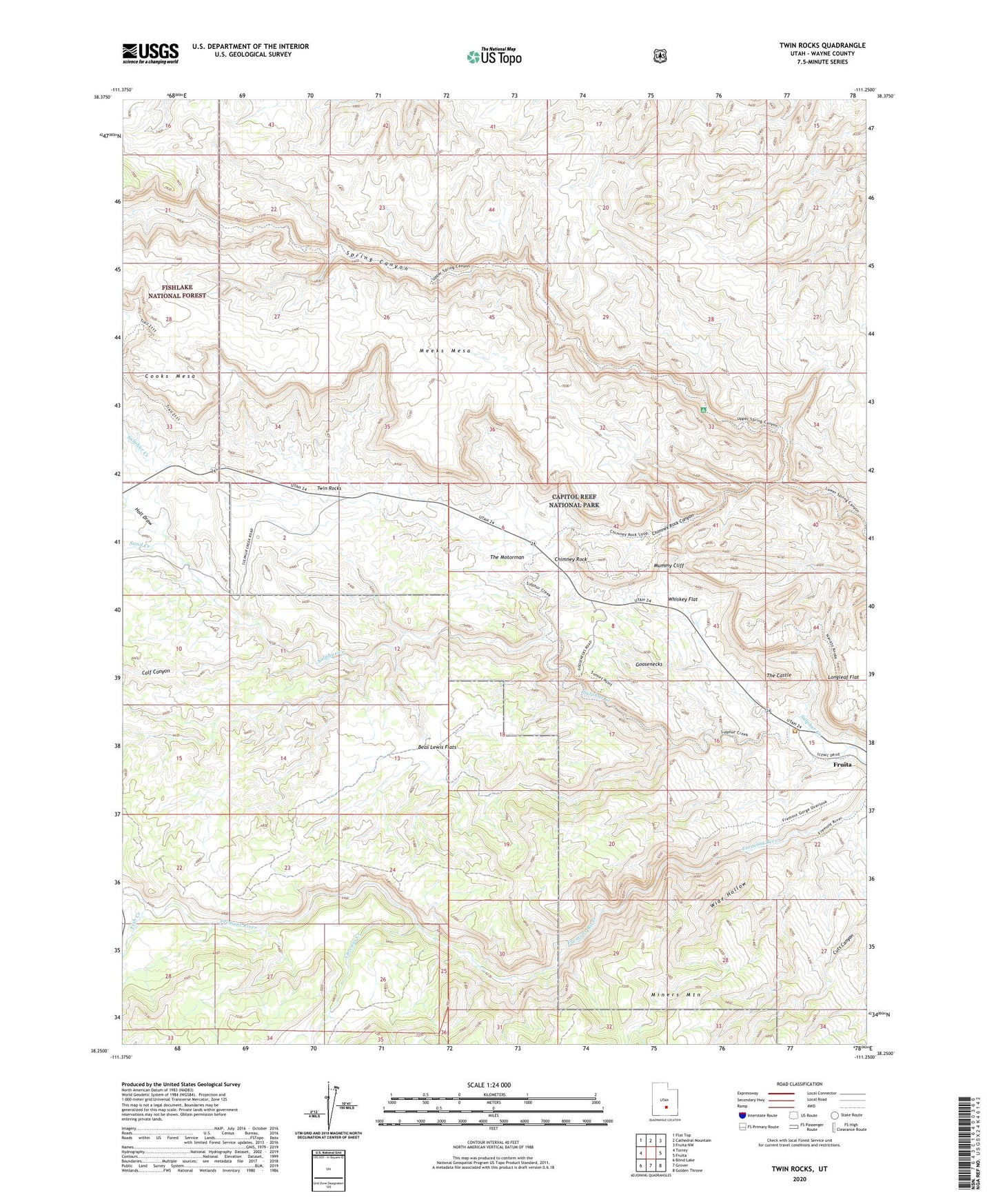
Twin Rocks Utah US Topo Map
Couldn't load pickup availability
Also explore the Twin Rocks Forest Service Topo of this same quad for updated USFS data
2023 topographic map quadrangle Twin Rocks in the state of Utah. Scale: 1:24000. Based on the newly updated USGS 7.5' US Topo map series, this map is in the following counties: Wayne. The map contains contour data, water features, and other items you are used to seeing on USGS maps, but also has updated roads and other features. This is the next generation of topographic maps. Printed on high-quality waterproof paper with UV fade-resistant inks.
Quads adjacent to this one:
West: Torrey
Northwest: Flat Top
North: Cathedral Mountain
Northeast: Fruita NW
East: Fruita
Southeast: Golden Throne
South: Grover
Southwest: Blind Lake
This map covers the same area as the classic USGS quad with code o38111c3.
Contains the following named places: Beas Lewis Flats, Calf Canyon, Capitol Reef National Park Visitor Center, Carcass Creek, Chimney Rock, Chimney Rock Canyon, Fish Creek, Goosenecks, Goosenecks Overlook, Holt Draw, Mummy Cliff, Sand Creek, The Castle, The Motorman, Twin Rocks, Whiskey Flat, Wide Hollow