MyTopo
Water Hollow Ridge Utah US Topo Map
Couldn't load pickup availability
Also explore the Water Hollow Ridge Forest Service Topo of this same quad for updated USFS data
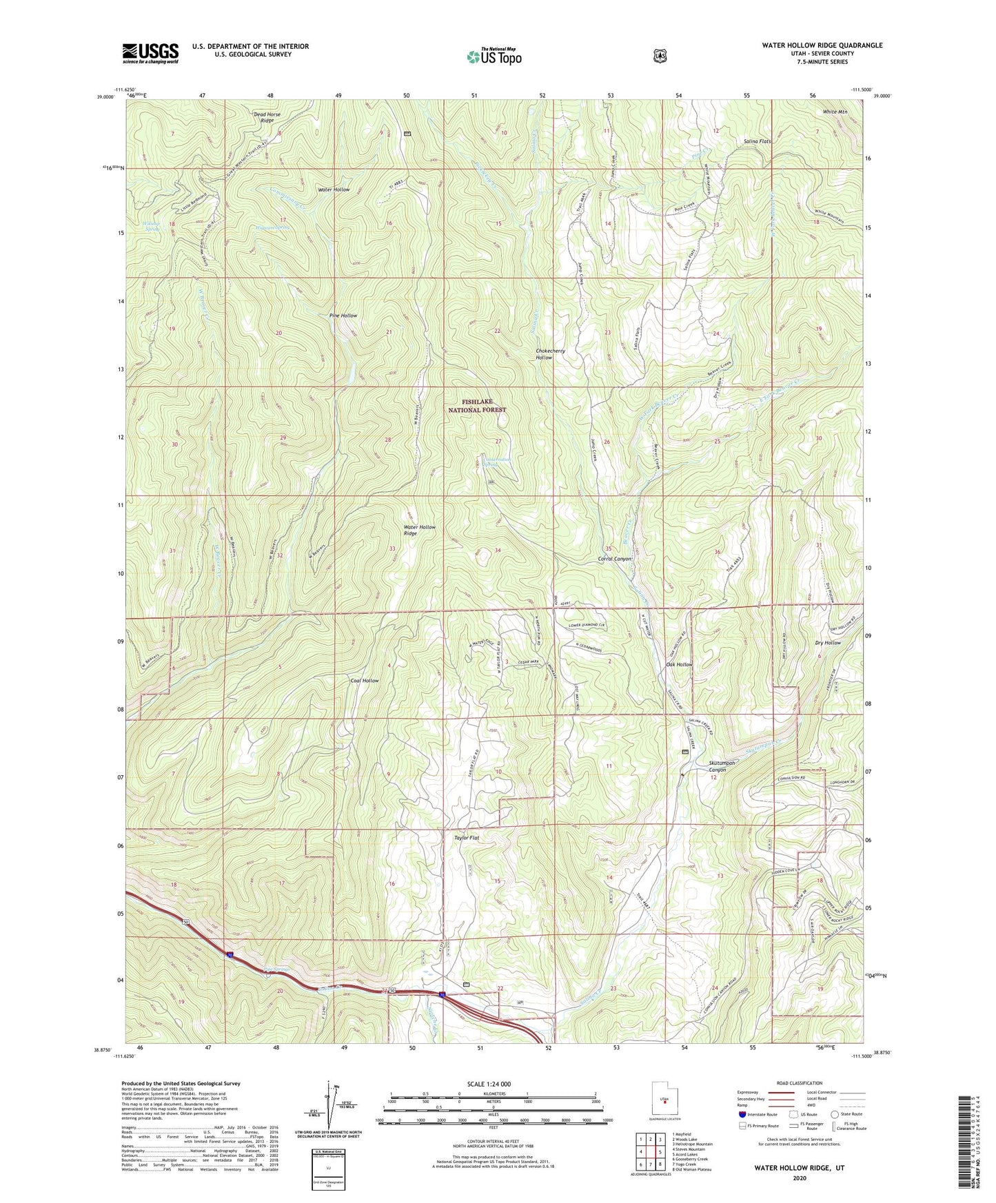
2023 topographic map quadrangle Water Hollow Ridge in the state of Utah. Scale: 1:24000. Based on the newly updated USGS 7.5' US Topo map series, this map is in the following counties: Sevier. The map contains contour data, water features, and other items you are used to seeing on USGS maps, but also has updated roads and other features. This is the next generation of topographic maps. Printed on high-quality waterproof paper with UV fade-resistant inks.
Quads adjacent to this one:
West: Steves Mountain
Northwest: Mayfield
North: Woods Lake
Northeast: Heliotrope Mountain
East: Acord Lakes
Southeast: Old Woman Plateau
South: Yogo Creek
Southwest: Gooseberry Creek
This map covers the same area as the classic USGS quad with code o38111h5.
Contains the following named places: Beaver Creek, Chokecherry Hollow, Commissary Creek, Conservation Spring, Corral Canyon, Dry Hollow, East Fork Beaver Creek, East Fork Picklekeg Creek, Meadow Creek, Niotche Creek, Oak Hollow, Picklekeg Creek, Pine Creek, Pine Hollow, Pipe Springs, Salina Canyon Dam Number 4, Salina Flats, Skutumpah Canyon, Skutumpah Creek, Taylor Flat, Water Hollow Ridge, West Beaver Creek, West Fork Beaver Creek, Wigwam Spring, Wikieup Spring