MyTopo
Allens Ranch Utah US Topo Map
Couldn't load pickup availability
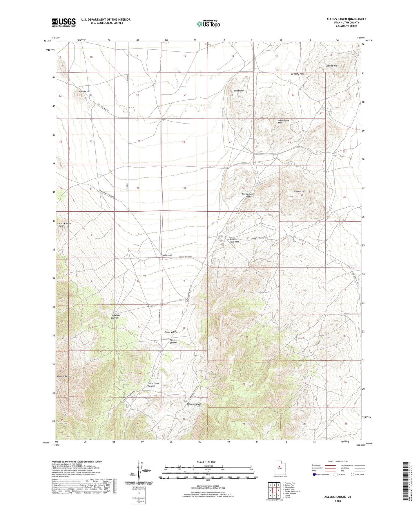
2023 topographic map quadrangle Allens Ranch in the state of Utah. Scale: 1:24000. Based on the newly updated USGS 7.5' US Topo map series, this map is in the following counties: Utah. The map contains contour data, water features, and other items you are used to seeing on USGS maps, but also has updated roads and other features. This is the next generation of topographic maps. Printed on high-quality waterproof paper with UV fade-resistant inks.
Quads adjacent to this one:
West: Boulter Peak
Northwest: Fivemile Pass
North: Goshen Pass
Northeast: Soldiers Pass
East: Goshen Valley North
Southeast: Goshen
South: Eureka
Southwest: Tintic Junction
This map covers the same area as the classic USGS quad with code o40112a1.
Contains the following named places: Allens Ranch, Chimney Rock Pass, Chiulos Canyon, Greeley Hill, Greeley Pass, Holdaway Canyon, John Jones Hill, Lehi Tintic, Long Point, Pinyon Canyon, Rattlesnake Pass, Selma Mine, Tenmile Hill, Tintic Davis Canyon, Tintic Empire, Tintic Paymaster, Tintic Paymaster Number 2, Wanlass Hill