MyTopo
Tintic Mountain Utah US Topo Map
Couldn't load pickup availability
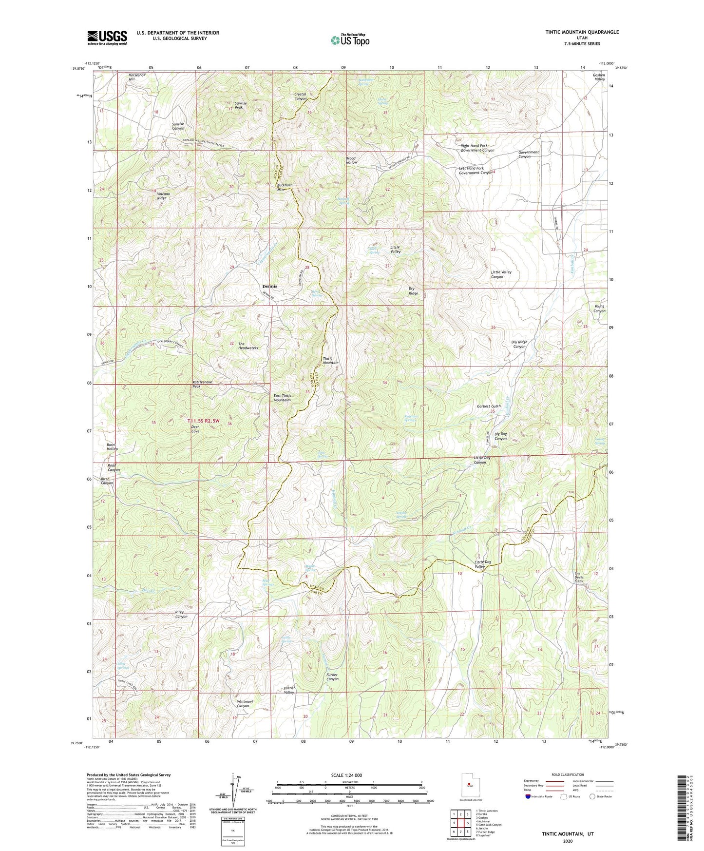
2023 topographic map quadrangle Tintic Mountain in the state of Utah. Scale: 1:24000. Based on the newly updated USGS 7.5' US Topo map series, this map is in the following counties: Juab, Utah. The map contains contour data, water features, and other items you are used to seeing on USGS maps, but also has updated roads and other features. This is the next generation of topographic maps. Printed on high-quality waterproof paper with UV fade-resistant inks.
Quads adjacent to this one:
West: McIntyre
Northwest: Tintic Junction
North: Eureka
Northeast: Goshen
East: Slate Jack Canyon
Southeast: Sugarloaf
South: Furner Ridge
Southwest: Jericho
This map covers the same area as the classic USGS quad with code o39112g1.
Contains the following named places: Andys Pond, Bens Spring, Big Dog Canyon, Birch Canyon, Bottlegger Spring, Broad Hollow, Buckeye Mine, Buckhorn Mountain, Burnt Hollow, Deer Cove, Dennis, Dry Ridge, Dry Ridge Canyon, Evelyn Mine, Furner Canyon, Garbett Gulch, Government Canyon, Hancock Ranch, Horse Spring, Horseshoe Hill, Jack Spring, Jims Spring, Jumpoff Spring, Kessler Spring, Keystone Springs, Left Hand Fork Government Canyon, Little Dog Canyon, Little Dog Valley, Little Valley, Little Valley Canyon, Maple Spring, Mud Springs, Nettle Spring, Old Susan Mine, Paul Bunyans Woodpile, Rattlesnake Peak, Right Hand Fork Government Canyon, Riley Springs, Rising Sun Mine, Road Canyon, Sunrise Canyon, Sunrise Peak, The Devils Steps, The Headwaters, Tintic Chief Mine, Tintic Mountain, Volcano Ridge, Whitmore Canyon, Young Canyon, Young Spring